Will Geo-HR sat be anti-sat proof? I do not think any anti-sat weapon can reach such height.Gerard wrote:Remote-sensing satellites usually circle the Earth at a height of a few hundred kilometres. ISRO plans to put a Cartosat-type camera on a satellite that will be placed in geostationary orbit at a distance of about 36,000 km. In this orbit, the satellite matches the Earth’s rotation and therefore appears stationary from the ground. Stationed over India, the Geo-HR Imager’ (as the satellite has been named) would be able to take images of the country and neighbouring regions whenever needed. .
Indian Space Program Discussion
-
vikas_pandey
- BRFite -Trainee
- Posts: 14
- Joined: 02 Sep 2005 15:44
- Contact:
Geo-HR Imager sat
Re: Indian Space Program Discussion - 23 April 2008
well I am not so sure -in fact it may be an easier target because of its predictable location and the height is not unreachable with some what larger booster carrying a small hit to kill KE type warhead or high explossive warhead . The ground track of a LEO/MEO orbiter can be easily changed not so for a geo orbitWill Geo-HR sat be anti-sat proof? I do not think any anti-sat weapon can reach such height.
Re: Indian Space Program Discussion - 23 April 2008
Put a video surveillance camera to scan the satellites surroundings to know what happened, then dushman ko maro goli
Re: Indian Space Program Discussion - 23 April 2008
Think about it, a GEO-Sat is stationed at 36,000 kms. If you have to put together something to reach that far it better be three times the size of any current ICBM in chi-coms inventory. A bit too much to prepare I would think!
Re: Indian Space Program Discussion - 23 April 2008
Think about killer satellites too. ASW need not be a missile!Anurag wrote:Think about it, a GEO-Sat is stationed at 36,000 kms. If you have to put together something to reach that far it better be three times the size of any current ICBM in chi-coms inventory. A bit too much to prepare I would think!
Re: Indian Space Program Discussion - 23 April 2008
At 36000 km, what kind of camera will be needed to get a decent resolution? AFAIK, most spy satellites are below 1000 km.
Re: Indian Space Program Discussion - 23 April 2008
Anti-Sat weapons are only used for Sats in lower earth/eliptical orbits. Never heard of an ASW for a Geo-Sat. Please enlighten if you have heard of anything that can go that far!
Mars Soil Can Support Life
The soil on Mars has been found to have nutrients which would be conducive to supporting life:
http://www.msnbc.msn.com/id/25396378/
All the more reason for us to go and start farming over there.
http://www.msnbc.msn.com/id/25396378/
All the more reason for us to go and start farming over there.
-
sanjaychoudhry
- BRFite
- Posts: 756
- Joined: 13 Jul 2007 00:39
- Location: La La Land
Re: Indian Space Program Discussion - 23 April 2008
NIce article about students at the ISRO-run Indian Institute of Space Science and Technology (IIST).
Kids are over the moon
http://www.newindpress.com/sunday/sunda ... ht&rLink=0
Kids are over the moon
http://www.newindpress.com/sunday/sunda ... ht&rLink=0
Re: Indian Space Program Discussion - 23 April 2008
wow!~ these kids must be lucky!..
btw, sanjay m, too much uv rays it says, killing organics. hence, I would it would be that simple. we must first create the atmosphere.. perhaps introduces those zillion microbes, to produce heat and carbon di oxide. we humans are pretty good at infecting, hence it should be possible. heating up mars planet must be the goal.
all space based countries can join and send long range missiles that carries the micropbial payload. it is also an excellent idea for ISRO/DRDO combine to test various strategic and defence systems as well. dual purpose agenda.
project, make mars hot!.
Re: Indian Space Program Discussion - 23 April 2008
Mars Soil Could Sustain Manned Outpost
If Mars soil is fertile enough to feed and sustain a manned outpost, then we should seek to bring about conditions for encouraging agriculture.
Constructing giant greenhouse domes on Mars would allow solar energy to be trapped inside for heating purposes, and also maintaining an Earth-like atmosphere inside them. Crops could be grown inside these giant domes, producing oxygen for a self-sustaining environment. This is also known as para-terraforming.
The domes could be made of strong lightweight kevlar fabric or even graphene, so that the internal atmospheric pressure will be enough to support their shape. Even lightweight fiber-reinforced aerogel could be useful for solid supports. Graphene of course has ultimate strength, and a thin layer would be transparent to most sunlight but enough to block UV. It would also be useful as a solar panel electrode to harvest photoelectric energy from the dome's surface.
I also had another idea, after reading a recent news article on a "Vortex Engine"...
Re: Indian Space Program Discussion - 23 April 2008
A Canadian engineer has been advocating the idea of an "Atmospheric Vortex Engine" -- a sort of controlled Tornado -- for generating power here on Earth:
http://www.livescience.com/environment/ ... ngine.html
http://vortexengine.ca/index.shtml
http://en.wikipedia.org/wiki/Vortex_engine
He has already build small working prototypes, but plans a larger demonstration this fall.
The idea is to use waste-heat from a large power source (eg. a powerplant) to then feed rising air currents in a cylindrical arena structure, to create a captive tornado that extends upwards for kilometers into the sky.
So this is a variant of the idea for the Solar Chimney, except that it uses "virtual walls" made out of air, thus effectively having no height limit, except the height limit of the atmosphere itself. The tornado is able to convert the heat energy fed into it to mechanical energy, by making use of the atmosphere's vertical temperature gradient.
Once started up, the tornado's vortex energy could be used to drive turbines also housed in the containment structure. The tornado would be captive and unable to leave the structure, because its power is dependent upon being fed by the waste heat source (presumably from a powerplant).
Making use of such a system on Mars could allow for the creation of a climatic differential for a local area. The system could be used to generate precipitation, and perhaps to alter barometric pressure and temperature in a way that is desirable for terraforming purposes.
It could also be used as an atmospheric processor to spew greenhouse gases and aerosol particles high into the Martian atmosphere. For example, Carbon Black (aka. gunpowder) consists of nanoparticles which are capable of absorbing 99.6% of incident solar radiation. If we had a powerplant on the ground making the stuff, and spewing it high into the atmosphere via an artificial vortex, then they would stay airborne for a long time, absorbing more of the sun's rays, helping to warm the planet.
Mankind should at least make use of supercomputers for modeling and studying climatology on Mars, in order to figure out how to best influence the Martian climate for terraforming purposes.
Re: Indian Space Program Discussion - 23 April 2008
I was also musing that Aerosol nanoparticles offer us the chance to engineer a variety of designer properties into them which would not be possible with your run-of-the-mill gases.
I was thinking that we could perhaps engineer designer nanoparticles whose properties were sensitive to temperature and pressure thresholds, such that they could then act as shuttles between the upper and lower Martian atmosphere.
For instance, since N2 is lighter and tends to float higher in the Martian atmosphere, perhaps we could have aerosol particles specialized for nitrogen capture/adsorption/fixation at higher altitudes, and after getting heavier from that they'd descend back towards the ground, where they'd release the nitrogen for more productive use by living things on the ground.
For those things that life might be too fragile to achieve on its own in the hostile Martian environment, nano-particles such as aerosols might be able to give enough of a helping hand with, so as to help life survive.
Re: Indian Space Program Discussion - 23 April 2008
Anybody seen these pictures from the surface of Venus?
http://wanderingspace.net/2006/11/the-s ... -revealed/
Pretty cool, if I may say. This is the first time I've seen them.
Taken by one of the Soviet-launched Venera probes sent to Venus during the 70s.

http://wanderingspace.net/2006/11/the-s ... -revealed/
Pretty cool, if I may say. This is the first time I've seen them.
Taken by one of the Soviet-launched Venera probes sent to Venus during the 70s.
Re: Indian Space Program Discussion - 23 April 2008
Wider horizons
The Indian Institute of Space Technology is expected to meet ISRO’s demand for quality manpower to launch its ambitious programmes.
The Indian Institute of Space Technology is expected to meet ISRO’s demand for quality manpower to launch its ambitious programmes.
Re: Indian Space Program Discussion - 23 April 2008
Though this may not strictly belong here, it is better to be aware of where China is going
China has made a breakthrough in developing its next generation of space-launch vehicle Long March V
With four boosters, the 59.5-meter-high environmentally friendly rocket's launching weight would reach 643 tonnes. It would be able to deliver a 25-tonne payload to an LEO, compared with the present 10 tonnes, and a 14-tonne payload to a GEO, compared with 5.5 tonnes now, said China Central Television in a report.
-
rachel
- BRFite
- Posts: 143
- Joined: 17 Jan 2008 01:27
- Location: www.canhindu.com
Re: Indian Space Program Discussion - 23 April 2008
SSridhar wrote:Though this may not strictly belong here, it is better to be aware of where China is goingChina has made a breakthrough in developing its next generation of space-launch vehicle Long March V
With four boosters, the 59.5-meter-high environmentally friendly rocket's launching weight would reach 643 tonnes. It would be able to deliver a 25-tonne payload to an LEO, compared with the present 10 tonnes, and a 14-tonne payload to a GEO, compared with 5.5 tonnes now, said China Central Television in a report.
No doubt that in launchers, India does need to really HURRY up if we're gonna catch up. Right now both Japan and China are capable of launching 5.5 t to GEO, while we can do 2 tonnes.
FULLY indigeous MK3 (4 t to GEO) is an absolute must, asap, if we're gonna catch up!
Re: Indian Space Program Discussion - 23 April 2008
Unkil's Lunar reconaissance orbiter(LRO) will be launched in october 2008. It is carrying a disc with names to the moon . All guys interested in sending names visit here
http://lro.jhuapl.edu/NameToMoon/index.php
such discs are there in almost all deep space missions like New Horizons(pluto), cassini(saturn), phoenix(mars) , dawn(asteroid) and others launched by unkil. wish ISRO too had something like this for chandrayaan-1 / chandrayaan-2.
http://lro.jhuapl.edu/NameToMoon/index.php
such discs are there in almost all deep space missions like New Horizons(pluto), cassini(saturn), phoenix(mars) , dawn(asteroid) and others launched by unkil. wish ISRO too had something like this for chandrayaan-1 / chandrayaan-2.
-
rachel
- BRFite
- Posts: 143
- Joined: 17 Jan 2008 01:27
- Location: www.canhindu.com
Re: Indian Space Program Discussion - 23 April 2008
I'd like to know which four satellites specifically that Unkil will get ISRO to launch.
Re: Indian Space Program Discussion - 23 April 2008
Meeting of ISRO – CNES joint working group held at Goa
17:53 IST
The Joint Working Group of the Indian Space Research Organization (ISRO) and the French Space Agency Centre National d’Etudes Spatiales (CNES) met at Goa during July 5-6, 2008 to review the progress of on-going collaborative programmes under the chairmanship of Dr. G. Madhavan Nair, Chairman, ISRO and Dr. Yannick d’Escatha, President, CNES.
The status of Megha Topiques, an Indo-French collaborative satellite project scheduled for launch during 2009 for tropical weather monitoring was presented during the meeting. Megha Tropiques carries four payloads – a Microwave Radiometer, a humidity sounder, a radiation measuring instrument and a Radio occultation sounder for atmospheric studies. During the meeting, an Agreement between ISRO and CNES on the Data Policy for distribution of data received from Megha Tropiques was also signed. This policy enables the global scientific community to have free access to Megha Tropiques data after calibration and evaluation of the payloads by scientists from both the agencies for weather and climate change studies. This data is expected to enhance a better understanding of the tropical weather phenomena including the monsoons.
The meeting also reviewed the status of SARAL, a small satellite mission with payloads from CNES for the study of ocean parameters towards enhancing the understanding of the ocean state conditions which are otherwise not covered by the in-situ measurements. The satellite carries a Ka band altimeter and a payload for reception of ARGO floats deployed all over the world oceans. The altimeter data will provide support in coastal environment studies, estuarine, bathymetry and preparedness towards Tsunami disaster. The periodic data collection over the oceans permits climate assimilations for improved weather forecast.
While reviewing the future collaborative projects, the teams emphasized the need for space-based observations for climate, environment and disaster management. Scientists from ISRO and CNES exchanged ideas for cooperation in conceiving space based systems and methodologies, which lead to a better understanding to tropical weather and climate. The cooperation between the two agencies will also enhance interaction between scientists outside space agencies in India and France and among the global scientific community. It was re-emphasized that technical and scientific strengths of ISRO and CNES would lead to evolving and establishing innovative operational space systems in addressing issues related to the tropical weather and climate. Both the agencies concluded that these efforts should facilitate achieving leadership position in understanding the tropical climate.
The meeting further re-established the relevance of the successful Indo-French cooperation in space activities.
PRA/SKK
-
Neela
- BRF Oldie
- Posts: 4104
- Joined: 30 Jul 2004 15:05
- Location: Spectator in the dossier diplomacy tennis match
Re: Indian Space Program Discussion - 23 April 2008
K.Kasturirangan presentation at Centre for Adv. Tech in February
http://www.cat.gov.in/happenings/fdaykkr.pdf
Information pertaining to Chandrayaan, mission objectives,instruments, ISRO's
preparation for it etc.
http://www.cat.gov.in/happenings/fdaykkr.pdf
Information pertaining to Chandrayaan, mission objectives,instruments, ISRO's
preparation for it etc.
-
Bade
- BRF Oldie
- Posts: 7212
- Joined: 23 May 2002 11:31
- Location: badenberg in US administered part of America
Re: Indian Space Program Discussion - 23 April 2008
U.S. Finds It's Getting Crowded Out There

There was an interesting chart in the hard copy edition which is not visible in the online one. Never mind here it isIronically, efforts to deny space technology to potential enemies have hampered American cooperation with other nations and have limited sales of U.S.-made hardware.
Concerned about Chinese use of space technology for military purposes, Congress ramped up restrictions on rocket and satellite sales, and placed them under the cumbersome International Traffic in Arms Regulations (ITAR). In addition, sales of potentially "dual use" technology have to be approved the State Department rather than the Commerce Department.
The result has been a surge of rocket and satellite production abroad and the creation of foreign-made satellites that use only homegrown components to avoid complex U.S. restrictions under ITAR and the Iran Nonproliferation Act. That law, passed in 2000, tightened a ban on direct or indirect sales of advanced technology to Iran (especially by Russia). As a result, a number of foreign governments are buying European satellites and paying the Chinese, Indian and other space programs to launch them.
"Some of these companies moved ahead in some areas where, I'm sorry to say, we are no longer the world leaders," Griffin said.
Joan Johnson-Freese, a space and national security expert at the Naval War College in Rhode Island, said the United States has been so determined to maintain military space dominance that it is losing ground in commercial space uses and space exploration. "We're giving up our civilian space leadership, which many of us think will have huge strategic implications," she said.
"Other nations are falling over each other to work together in space; they want to share the costs and the risks," she added. "Because of the dual-use issue, we really don't want to globalize."
Re: Indian Space Program Discussion - 23 April 2008
OT post:
Beloveds! Will someone pls direct me to an online resource where I can do simulations of satellite period (and earth tracks if possible) for various sorts of orbits like Molniya, Sun-sync, other polar orbits etc.? Graphical output not essential, a few numbers would be nice. I am too stupid and way too lazy to try making my own from the equations, or to go use DTK etc.
Also, a resource where I can credibly relate launch cost to satellite mass and orbit, for order-of magnitude cost estimation? The NASA-USAF cost models seem to give me development and production costs, but not launch cost, and they don't ask for orbit height.
Thanks! May your camels never eat your tents.
Re: Indian Space Program Discussion - 23 April 2008
India has to get to 50 sattelites launches a year with about 1 Billion $ in civilian revenues to become any sort of player of significance in the world space market.
-
rachel
- BRFite
- Posts: 143
- Joined: 17 Jan 2008 01:27
- Location: www.canhindu.com
Re: Indian Space Program Discussion - 23 April 2008
venkat_r wrote:India has to get to 50 sattelites launches a year with about 1 Billion $ in civilian revenues to become any sort of player of significance in the world space market.
WHY is India's satellite revenues so low? EVen South Korea, Canada, and Brazil have much higher revenues. WHy? Our number of sats and launches is much higher!
-
Bade
- BRF Oldie
- Posts: 7212
- Joined: 23 May 2002 11:31
- Location: badenberg in US administered part of America
Re: Indian Space Program Discussion - 23 April 2008
Dr. Kelso has the solution you need perhaps.narayanan wrote:OT post:
Beloveds! Will someone pls direct me to an online resource where I can do simulations of satellite period (and earth tracks if possible) for various sorts of orbits like Molniya, Sun-sync, other polar orbits etc.? Graphical output not essential, a few numbers would be nice. I am too stupid and way too lazy to try making my own from the equations, or to go use DTK etc.
http://www.movingsatellites.com/gr_main2.jpg
http://celestrak.com/software/tskelso-sw.asp
-
Bade
- BRF Oldie
- Posts: 7212
- Joined: 23 May 2002 11:31
- Location: badenberg in US administered part of America
Re: Indian Space Program Discussion - 23 April 2008
Low volume of orders combined with highly deflated charges compared with competitors mean less total revenues.WHY is India's satellite revenues so low?
-
rachel
- BRFite
- Posts: 143
- Joined: 17 Jan 2008 01:27
- Location: www.canhindu.com
Re: Indian Space Program Discussion - 23 April 2008
I wonder if the charges being low are just because we can do more for less, or because rates being kept artifically low for domestic users (ie subisdized).Bade wrote:Low volume of orders combined with highly deflated charges compared with competitors mean less total revenues.WHY is India's satellite revenues so low?
If we can launch for less money/launch, we should get a lot of bizness (more birds purchased from various users).
Re: Indian Space Program Discussion - 23 April 2008
We really need to do more on marketing our services.
Oh well, once we go to the Moon with Chandrayaan, everyone everywhere will be hearing about it.
But how come we have such a crummy-looking low-tech mission control screen, when you see televised footage of our launches? It looks horrible -- like a videogame from the early 1980s.
Can't our land of software gurus come up with something that at least looks a little snazzier than that? I doubt it would kill their budget to do this.
Re: Indian Space Program Discussion - 23 April 2008
Now this is an interesting example of good marketing by NASA:
Send Your Name to the Moon
India should do this with Chandrayaan.
Send Your Name to the Moon
India should do this with Chandrayaan.
Re: Indian Space Program Discussion - 23 April 2008
Any news on the Hyperplane front?.
Re: Indian Space Program Discussion - 23 April 2008
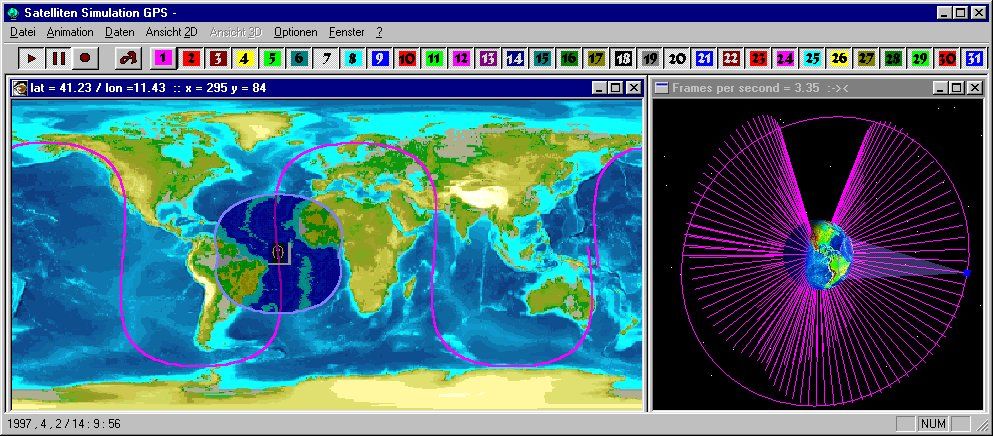
Thanks, Bade. Unfortunately that needs a PC and learning curve, which makes it less optimal than conning some poor soul into using the STK system which is also accessible at work. 
The space cadets here may find this site very educational:
http://www.educypedia.be/education/spacejava.htm
I saw at least one cool animation there of satellites in elliptical orbits (I set the velocity) around the Earth and the Earth moves around the Sun.
And this one is so cool that several denizens here may disappear altogether, like my spacecraft did when I set a velocity and waited and waited for it to return. Until I realized that I had given it more than escape velocity.
-
rachel
- BRFite
- Posts: 143
- Joined: 17 Jan 2008 01:27
- Location: www.canhindu.com
Re: Indian Space Program Discussion - 23 April 2008
Bade wrote:Low volume of orders combined with highly deflated charges compared with competitors mean less total revenues.WHY is India's satellite revenues so low?
Looking at that chart again, I see Russia has a huge number of launches and satellites, but quite low revenues.
Thinking about it further, I think it's because most of the buyers of the satellites have been domestic state-owned users, and the satellite manufacturers (also state-run firms) have been ORDERED to charge low prices, regardless of cost of production.
A natural consequence of one state-run firm dealing with another, with distortion of costs and pricing, I suppose.
It's reasonable that Russia does this, but funny that India is the only other nation in this group that also does it. Looks like China does it to some extent also: consider that China has built and launched way moe satellites than Canada, yet revenue is the same for both!
Weird distortion. A person looking solely at revenues may think Canada's space sector is equal to China's...but nothign could be further from the truth!
That person would also conclude that India's space sector is the lowiest of them all.. behind even Brazil and Canada !!
I dont like India being placed last on any list, for that reason. There are stupid people out there who'll try to denigrate our space achievements by using a list like that against us!
Re: Indian Space Program Discussion - 23 April 2008
Nova fro Windows from Northern Lights Software Associates is a very good and simple tool not requiring a lot of learning. Demo copy can be downloaded and it has all the features of final product. http://www.nlsa.comnarayanan wrote:OT post:
Beloveds! Will someone pls direct me to an online resource where I can do simulations of satellite period (and earth tracks if possible) for various sorts of orbits like Molniya, Sun-sync, other polar orbits etc.? Graphical output not essential, a few numbers would be nice. I am too stupid and way too lazy to try making my own from the equations, or to go use DTK etc.
S^3
Re: Indian Space Program Discussion - 23 April 2008
http://pib.nic.in/release/release.asp?relid=40292
Indian Institute of Space Science and Technology (IISST) Thiruvanathapuram Declared as Deemed to be University
http://www.indiaedunews.net/Science/Wat ... an%5F5133/
Water on moon - new evidence an impetus to Chandrayaan
Indian Institute of Space Science and Technology (IISST) Thiruvanathapuram Declared as Deemed to be University
http://www.indiaedunews.net/Science/Wat ... an%5F5133/
Water on moon - new evidence an impetus to Chandrayaan
Re: Indian Space Program Discussion - 23 April 2008
Raytheon led team to bid for final phase of GAGAN - India's satellite-based navigation system news.
Raytheon Company is leading a team to deliver a comprehensive solution for the Indian Space Research Organization (ISRO) and Airports Authority of India (AAI) global navigation satellite systems.
The solution will complete the final phase of the Global Positioning Satellite (GPS) aided Geosynchronous Augmented Navigation System (GAGAN).
GAGAN will provide satellite-based navigation for civil aviation across South and East Asia, providing India with the most accurate, flexible and efficient air navigation system deployed.
The GAGAN design is based on the experience gained delivering the only certified space-based augmentation systems. For instance, the Wide Area Augmentation System (WAS) was certified by the Federal Aviation Administration (FAA) in July 2003, and the MTSAT Satellite Augmentation System was certified by the Japanese Civil Aviation Bureau in September 2007.
"We look forward to continuing our collaborative relationship with ISRO and AAI during this critical phase of GAGAN," said Andy Zogg, Raytheon vice president of airspace management and homeland security. "We are committed to a thorough transfer of knowledge of the GAGAN system to further enhance India's leadership position in air navigation."
The Raytheon team will leverage the experience gained during the past several years in deploying the technology demonstration system phase of GAGAN. Team members include Bangalore based Accord Software and Systems Pvt. Ltd. for GPS-based user receiver prototype development optimized for the equatorial region; Gurgaon-based Elcome Technologies Pvt. Ltd. for logistical and on-site support; and Naverus, Inc., of Kent, Washington, for performance-based navigation route design, procedure flight validation and other related services.
Re: Indian Space Program Discussion - 23 April 2008
I don't think we have capability to launch 50 satellites a year ( unless its 10 sats per launch). The lauch facilities at Sriharikota cannot handle so many launches ( I suppose its max 8 per year ). We need to increase the infrastructure at Sriharikota. Maybe restart launches from Thumba. ISRO dosen't get the funding it deserves. Ideally the annual budget should be in the range of 2-2.5 Billion $, but we have to manage with under a billion. Additional launch Pads should cost around Rs 500 crores each. Unless we get a political leadership that is passionate about space, things will keep on moving slowly. Its only due the top class scientists and engineers that ISRO has managed to develop advanced technologies with frugal funding.venkat_r wrote:India has to get to 50 sattelites launches a year with about 1 Billion $ in civilian revenues to become any sort of player of significance in the world space market.