http://www.claudearpi.net/maps
Lot of maps but no arrows nd timelines
Btw why did they return tawang? Would it not be a strategic prize and panditji had zero credibility to threaten them
Latest Chinese boast: should we shiver or die laughing?
Re: Latest Chinese boast: should we shiver or die laughing?
they built the dirt track which is today the road to tawang from the plains..Bhalukpong is it? its only in recent times have we tried to improve it. i was on this road in 2012 and work was being carried out..
Re: Latest Chinese boast: should we shiver or die laughing?
PLA logistics had collapsed. There would be no food with civilian population moving out and very difficult to get supplies from Tibet. Tibet is no great place to grow food for a army. Ammo can only last until the next fight.Singha wrote: Btw why did they return tawang? Would it not be a strategic prize and panditji had zero credibility to threaten them
Against this, IA was coming at them. The PLA would have been decimated, leaving the doors to Lhasa open.
The Soviet had stopped help to Chinese nuke in 59. So Soviet help was iffy.
Going back to where they started, removed the excuse for India to invade Tibet and also prepare in case there was a Indian counter attack.
Re: Latest Chinese boast: should we shiver or die laughing?
i guess it was september with the mountains getting snowbound soon... they could have been stranded on this side..it was not about food but about fighting capability. the idea was to teach Nehru a lesson not so much to occupy territory. I am not sure the current rhetoric about AP being part of tibet and so chinese territory was so strident then.
Re: Latest Chinese boast: should we shiver or die laughing?
I believe bhalukpong bomdila sela tawang has always been the sole road to tawang . PLA used some other tracks to bypass sela and make haste for bomdilla and beyondmanjgu wrote:they built the dirt track which is today the road to tawang from the plains..Bhalukpong is it? its only in recent times have we tried to improve it. i was on this road in 2012 and work was being carried out..
IA had no supplies or infra outside this route so any bypassed points either had to surrender, fight with little hope of resupply or try to escape xcountry to bhutan which some did.
In this one month nehru was probably kept in dark for 2 weeks by his appointees like kaul...in anothef 2 weeks before much could be mobilized for a counter attack a ceasefire was declared
What i am curious to know is other than panditji wailing for american bombers to bomb the chinese ( why want iaf allowed to atleast try ) what units had been ordered into eastern sector and what was the plan to counterattack if any?
Did we have any concrete plan if pla just decided not to move back and dared india to fight?
Re: Latest Chinese boast: should we shiver or die laughing?
If I find out by the time I finish reading the book I am reading I will post.Singha wrote:http://www.claudearpi.net/maps
Lot of maps but no arrows nd timelines
Btw why did they return tawang? Would it not be a strategic prize and panditji had zero credibility to threaten them
Most likely it was logistics and the knowledge that other Indian army units moving in would massacre them on the plains. Perhaps a smattering of concern about Amreeka aircraft. Will get back on these points in due course but don't hold your breath.
Re: Latest Chinese boast: should we shiver or die laughing?
Is the entire story of the American involvement in 62 out in the open? I first read about the Americans sending C130s etc for the first time only during the nuclear deal bonhomie, with PR material reminiscing how they came to our help in our time of need etc. Was this a well known fact previously or something that came out only recently. If its the latter I wonder what else is still was kept under wraps.
Re: Latest Chinese boast: should we shiver or die laughing?
BTW why does most of the discussions on topic such as this dwell only on AP/Sikkim/Ladakh and none on HP/UK? Is the border here settled or is there no threat perception in these regions? Also what is the IA deployment, and why no strike corp here?
-
ArjunPandit
- BRF Oldie
- Posts: 4056
- Joined: 29 Mar 2017 06:37
Re: Latest Chinese boast: should we shiver or die laughing?
There was another story about a some tracking device placed in mountains to track chinese nuclear tests. That device was lost in mountains http://timesofindia.indiatimes.com/indi ... w/7835.cms
Re: Latest Chinese boast: should we shiver or die laughing?
Deleted duplicate.
Last edited by sudarshan on 16 Apr 2017 19:37, edited 1 time in total.
Re: Latest Chinese boast: should we shiver or die laughing?
There's no such thing as a "settled border" when dealing with China. China considers all borders as disputed, pending resolution - by which they mean, Chinese expansion at a date of their convenience.abhik wrote:BTW why does most of the discussions on topic such as this dwell only on AP/Sikkim/Ladakh and none on HP/UK? Is the border here settled or is there no threat perception in these regions? Also what is the IA deployment, and why no strike corp here?
Just go to google maps and expand the region near HP/UK or even Nepal. You will see several dashed lines, which are supposed to show "disputed" status. And what is the nature of the dispute? Simply the fact that there was a Chinese incursion in these areas. I suspect that google waits until a Chinese incursion happens (even if it's just five or ten soldiers crossing the border for a few hours), and then immediately and gleefully marks those areas in dotted lines. In fact, in some instances, Nepalis (I don't know if they were actually soldiers) crossed to the Indian side, and google marked those areas as disputed between India and Nepal.
Here - you can clearly see all the areas marked as disputed by google - these are in HP and UK. There's one on the Indo-Nepal border as well.
https://www.google.com/maps/@31.0025208 ... 3418,7.75z
Re: Latest Chinese boast: should we shiver or die laughing?
When IA went on expansion spree especially with respect to deployment against China, it had asked for 3 x independent infantry brigades and 2 x armored brigades.abhik wrote:BTW why does most of the discussions on topic such as this dwell only on AP/Sikkim/Ladakh and none on HP/UK? Is the border here settled or is there no threat perception in these regions? Also what is the IA deployment, and why no strike corp here?
2 of these 3 independent infantry brigade groups (one each) are meant for the HP-Tibet and UK-Tibet border. In case of UK-Tibet border, it will add to existing independent infantry brigade group and help to rationalize the Area-of-Responsibility (AOR). In case of HP-Tibet border, it adds more troops, capability and formalizes a loose structure which existed for decades.
Further, IA has 6 Mountain Div based out of Bareilly. It is AHQ reserve which is tasked for UK-Tibet border in case of a shooting match with Chinese. Also deployed west in case of tensions with Pakistan.
Re: Latest Chinese boast: should we shiver or die laughing?
The western part of nepal called for some reason as Mustang is said to fairly desolate like aksai chin. Not many trekkers even go there.
Re: Latest Chinese boast: should we shiver or die laughing?
Singha, Mustang was also the base of CIA backed Khampa rebellion in late 50s. It was out of bounds for many years.Singha wrote:The western part of nepal called for some reason as Mustang is said to fairly desolate like aksai chin. Not many trekkers even go there.
Re: Latest Chinese boast: should we shiver or die laughing?
sudarshan wrote:There's no such thing as a "settled border" when dealing with China. China considers all borders as disputed, pending resolution - by which they mean, Chinese expansion at a date of their convenience.abhik wrote:BTW why does most of the discussions on topic such as this dwell only on AP/Sikkim/Ladakh and none on HP/UK? Is the border here settled or is there no threat perception in these regions? Also what is the IA deployment, and why no strike corp here?
Just go to google maps and expand the region near HP/UK or even Nepal. You will see several dashed lines, which are supposed to show "disputed" status. And what is the nature of the dispute? Simply the fact that there was a Chinese incursion in these areas. I suspect that google waits until a Chinese incursion happens (even if it's just five or ten soldiers crossing the border for a few hours), and then immediately and gleefully marks those areas in dotted lines. In fact, in some instances, Nepalis (I don't know if they were actually soldiers) crossed to the Indian side, and google marked those areas as disputed between India and Nepal.
Here - you can clearly see all the areas marked as disputed by google - these are in HP and UK. There's one on the Indo-Nepal border as well.
https://www.google.com/maps/@31.0025208 ... 3418,7.75z
I am looking at those areas now and I tell ya this is the weirdest thing I have seen yet. Those "disputed areas" are simply a Chinese claim where they can simply try and come in anytime. That is the theory. But the terrain is so hostile that the Arunachal Pradesh area terrain cannot hold a candle to this area. The mountains are s_e_r_i_o_u_s_l_y high in this area - over 5 km and often 6. I can see Indian positions at the height of 5 km - and even some Indian tourist destinations in that "disputed" area. But there is virtually no Chinese presence. There are not even any serious roads apart from the G219 that is 70-80 km away as the crow flies.
I will do a description of these areas but here I want to quote Shaurya - I was going to do a separate reply but I will do it here:
Actually no. In fact it is the Chinese who are well equipped to make the threat with almost no troops in the area. They could conceivably bring in troops to occupy some positions in the areas they claim. But they can stay away if the wish and laugh at the Indian sitting up at 5-6 km guarding empty land - knowing that Indians have to climb 5 km to get there while all they have to do is come 2000 km by good road (OK 1000 km)wrote:At this time, we are occupied with only defending the LAC, a task we are well equipped to do
But in fact if push comes to shove we should be able to grab Aksai Chin.
Last edited by shiv on 16 Apr 2017 20:12, edited 1 time in total.
Re: Latest Chinese boast: should we shiver or die laughing?
The Americans have played a fairly deep role here.ArjunPandit wrote:There was another story about a some tracking device placed in mountains to track chinese nuclear tests. That device was lost in mountains http://timesofindia.indiatimes.com/indi ... w/7835.cms
In Nehru's early days when they were opposing Mao - Tibetan rebels were supplied American arms and ammunition via airdrops. I need to get back to source to recall but I think many were in Nepal but there was an Indian hand giving support and many of the Tibetans were in India. There was no "Arunachal Pradesh" then - it was called NEFA (North East Frontier Agency) (There was no Karnataka back then for that matter -it was Mysore state). Tibetans were actually taken to the US for Guerilla training. Many accounts/books exist. I need to find my own sources but I recall vsunder had given me 3 terrific books that I must re read.
Yes there was a Plutonium powered listening device that was lost. It's probably still there somewhere in the permafrost.
Re: Latest Chinese boast: should we shiver or die laughing?
But folks- Never whine and argue about India's helicopter needs. we need them bad.
-
ArjunPandit
- BRF Oldie
- Posts: 4056
- Joined: 29 Mar 2017 06:37
Re: Latest Chinese boast: should we shiver or die laughing?
[OT]shiv wrote:The Americans have played a fairly deep role here.ArjunPandit wrote:There was another story about a some tracking device placed in mountains to track chinese nuclear tests. That device was lost in mountains http://timesofindia.indiatimes.com/indi ... w/7835.cms
In Nehru's early days when they were opposing Mao - Tibetan rebels were supplied American arms and ammunition via airdrops. I need to get back to source to recall but I think many were in Nepal but there was an Indian hand giving support and many of the Tibetans were in India. There was no "Arunachal Pradesh" then - it was called NEFA (North East Frontier Agency) (There was no Karnataka back then for that matter -it was Mysore state). Tibetans were actually taken to the US for Guerilla training. Many accounts/books exist. I need to find my own sources but I recall vsunder had given me 3 terrific books that I must re read.
Yes there was a Plutonium powered listening device that was lost. It's probably still there somewhere in the permafrost.
The ability of Khan to play both sides and switch sides as and when it wants with the other side not realizing they have been screwed badly is a case
study in the entire history of mankind. They have even beaten brishits in that game.
Dr Saab, are there any books on how indian state borders were carved. Few years back I watched a serial "How states got their shapes", about how khan states got their shapes. It was an interesting watch. Got me interested in something similar for India.
[/OT]
Re: Latest Chinese boast: should we shiver or die laughing?
A youtube video is right here on the thread. Tells all about training in US and the base in Nepal.shiv wrote:The Americans have played a fairly deep role here.ArjunPandit wrote:There was another story about a some tracking device placed in mountains to track chinese nuclear tests. That device was lost in mountains http://timesofindia.indiatimes.com/indi ... w/7835.cms
In Nehru's early days when they were opposing Mao - Tibetan rebels were supplied American arms and ammunition via airdrops. I need to get back to source to recall but I think many were in Nepal but there was an Indian hand giving support and many of the Tibetans were in India. There was no "Arunachal Pradesh" then - it was called NEFA (North East Frontier Agency) (There was no Karnataka back then for that matter -it was Mysore state). Tibetans were actually taken to the US for Guerilla training. Many accounts/books exist. I need to find my own sources but I recall vsunder had given me 3 terrific books that I must re read.
Yes there was a Plutonium powered listening device that was lost. It's probably still there somewhere in the permafrost.
Re: Latest Chinese boast: should we shiver or die laughing?
This was posted earlier as well. Re-posting it in light of discussion about the UK-Tibet border.
The case of Barahoti, the first Himalyan blunder
http://claudearpi.blogspot.in/2017/01/t ... alyan.html
The case of Barahoti, the first Himalyan blunder
http://claudearpi.blogspot.in/2017/01/t ... alyan.html
Re: Latest Chinese boast: should we shiver or die laughing?
We have to ensure Tibet is independent, and thus create a buffer state between India and China.
I fully support one-china policy, however without tibet in middle of PRC and India, there is a threat of nuclear war which is threat to whole humanity. Hence, tibet is crucuial for world peace and prosperity.
I fully support one-china policy, however without tibet in middle of PRC and India, there is a threat of nuclear war which is threat to whole humanity. Hence, tibet is crucuial for world peace and prosperity.
[/quote]shiv wrote:sudarshan wrote:
There's no such thing as a "settled border" when dealing with China. China considers all borders as disputed, pending resolution - by which they mean, Chinese expansion at a date of their convenience.
Just go to google maps and expand the region near HP/UK or even Nepal. You will see several dashed lines, which are supposed to show "disputed" status. And what is the nature of the dispute? Simply the fact that there was a Chinese incursion in these areas. I suspect that google waits until a Chinese incursion happens (even if it's just five or ten soldiers crossing the border for a few hours), and then immediately and gleefully marks those areas in dotted lines. In fact, in some instances, Nepalis (I don't know if they were actually soldiers) crossed to the Indian side, and google marked those areas as disputed between India and Nepal.
Here - you can clearly see all the areas marked as disputed by google - these are in HP and UK. There's one on the Indo-Nepal border as well.
https://www.google.com/maps/@31.0025208 ... 3418,7.75zVery well put Sudarshan! +1
I am looking at those areas now and I tell ya this is the weirdest thing I have seen yet. Those "disputed areas" are simply a Chinese claim where they can simply try and come in anytime. That is the theory. But the terrain is so hostile that the Arunachal Pradesh area terrain cannot hold a candle to this area. The mountains are s_e_r_i_o_u_s_l_y high in this area - over 5 km and often 6. I can see Indian positions at the height of 5 km - and even some Indian tourist destinations in that "disputed" area. But there is virtually no Chinese presence. There are not even any serious roads apart from the G219 that is 70-80 km away as the crow flies.
I will do a description of these areas but here I want to quote Shaurya - I was going to do a separate reply but I will do it here:Actually no. In fact it is the Chinese who are well equipped to make the threat with almost no troops in the area. They could conceivably bring in troops to occupy some positions in the areas they claim. But they can stay away if the wish and laugh at the Indian sitting up at 5-6 km guarding empty land - knowing that Indians have to climb 5 km to get there while all they have to do is come 2000 km by good road (OK 1000 km)wrote:At this time, we are occupied with only defending the LAC, a task we are well equipped to do
But in fact if push comes to shove we should be able to grab Aksai Chin.
Re: Latest Chinese boast: should we shiver or die laughing?
Link to doc version of the book - CIA's Secret War in Tibet.
https://tinyurl.com/m36ejpm
You can read about the book here:
https://www.amazon.com/CIAs-Secret-Tibe ... NP720VSZ89
https://tinyurl.com/m36ejpm
You can read about the book here:
https://www.amazon.com/CIAs-Secret-Tibe ... NP720VSZ89
Re: Latest Chinese boast: should we shiver or die laughing?
I have now spent a fair number of hours staring at Google Earth images and have had a chance to compare and correct impressions that I had gained 3 years ago when I first did the Aksai Chin side as an article on DFI. Arunachal Pradesh and the surrounding area has such rich detail that I was initially daunted but it worked out OK.
But now going to the Barahoti area I am stumped. The area is surreal. I have become pretty good at picking up small differences in patterns to recognize roads and human "interference" in the terrain. But the area of Tibet north-east of Himachal and Uttrakhand is bleak. OK there is the Chinese provincial road G 219 about 70-80 km from the border/LAC. But that 70-80 km stretch is bleak.
On the Indian side of the LAC/border there are mountains and winding roads leading up to Indian positions. Beyond that - into Tibet - I can hardly see any activity. Forget Chinese military - I can't even see roads or paths. Yeah they must be there, and yes I may have to revise some of this - but I don't miss major features - and whenever any humans build anything big, they have roads visible - especially the Chinese.
When I read that Claude Arpi article about the Chinese coming in the impression I get is that those guys must be there nearby in some strength. There must be a base and/or roads. But wtf? Nothing. It's almost as those those guys came on a picnic/trek to the LAC - did gaandmasti with Indians and went off. I am still looking and will continue to look for evidence of access areas for the Chinese. Claude Arpi is right in saying that the Tibet side is a plain that allows easy access to the LAC for the Chinese. Much more difficult for Indians to reach. I have a philosophical muse about this but I will make a separate post. Anyhow I will keep looking for features.
Arpi also says that a Chinese helicopter landed there. That always attracts my attention. Where might it have come from? And guess what - there is at least one air-base that I have missed. There is a Chinese airfield that is 40 km south-east of the Chinese town of Ngari. That airfield is a typical "Tibet airfield" - very high altitude (4300m) and very long runway 4.6 km. - and is about 120 odd km from the border/LAC.
Re: Latest Chinese boast: should we shiver or die laughing?
When I look north of the border at the bleak landscape of Tibet beyond the LAC/border and then look south at the massive Himalayas on top of which Indian forces have to sit to watch over the bleak plain so the Chinese don't creep in, I suddenly get a thought that connects the history of India and its neighbours.
In the hoary past Tibet was Tibet ad people by Tibetans who could survive there. The land could not and still cannot grow much food and it had a very small population. Moving south we find the Himalayas. The Himalayas are even higher and even more bleak than Tibet. Tibetans, plains people, herders did not inhabit the mountains. The mountains were inhabited by tribes - some fierce and some traders. South of the Himalayas is India. Hot fertile and productive - and has been densely populated forever. Indians did not want too much to do with living in the Himalayas. Vast uninhabited regions were peppered with holy men and truthseekers and the few tribespeople who existed
There were no borders or demarcated boundaries. every now and again a mountain tribe (say Gurkhas or Nagas) wouth attack Tibet, or would attack the plains. Sometimes Tibetans would get into the mountain areas and rule. And sometimes kings from the plains would gram mountain land and parts of Tibet. China. Tibet and India were civilizational states, not nation states.
This worked until the Renaissance of Europe and the industrial revolution - with the birth of nation states with fixed borders.
Now both India and China have internalized the concept of "nation state" with fixed borders. What this has done is to essentially cause both nation states to try and mark their boundaries in territories that had no fixed boundaries. Tibet has been swallowed up by China - the Chinese are trying to make an ancient civilizational state into part of the Chinese nation state. Some mountain states like Bhutan and Nepal still exist. Sikkim has joined India.
India the nation state has to protect its boundaries by climbing up the mountains to the Tibetan plain to ensure its integrity as a nation state. China the nation state is already sitting on that plain and is trying to push its borders outwards to try and push India down-mountain. There is an inherent geographical disadvantage to India in having to maintain forces well above the plains. But China too has a geographical problem or two. One is the extreme altitude and hostile climate of Tibet and the great remoteness of Tibet which make Chinese logistics lines excruciatingly long. Anything India does to improve logistics is advantage India because there is little that China can do to move Tibet closer to Beijing. That does not mean that we can walk in and take Tibet. Once there we will suffer many of the same disadvantages faced b China - but we can mitigate that by good logistics.
Re: Latest Chinese boast: should we shiver or die laughing?
Pla has got these light atv which might permit batallions to off road in flat tibet upto the border much quicker than walking
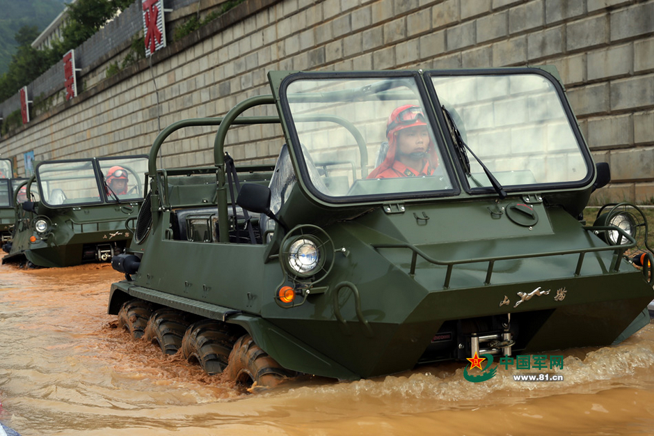

These are portable by mi17. They license make mi17.
Ideal tools for probing intrusions to needle india then drive away to watch the fun. They can pick and choose points and depth
They have mmg and can carry atgms and 81mm mortars and can quickly defeat isolated indian foot patrols with only small arms and maybe rpg. We cannot easily take vehicles up through the heights to disputed areas and retrieve them by air after the mission. We probably need armed uav like reapers for patrol support.
Re: Latest Chinese boast: should we shiver or die laughing?
Yes but they leave tyre tread marks visible on images. Even those are missing from crucial areas. For example there is a short distance from the G 219 near Barahoti that shows scores of tracks. but keep searching as you get closer to the LAC and nothing is seen. The Chinese do not simply keep off road vehicles. They use regular paths and leave characteristic markings which are recognizable all over Tibet. Maybe if a vehicle passes once in a while nothing will be seen, but a regular presence cannot be hidden. There are huge huge areas with no evidence of regular presence.
Apart from that - the main roads/paths will have stops or settlements for fuel and rest. Where are they? I am still searching will mark all and post if any.
Apart from that - the main roads/paths will have stops or settlements for fuel and rest. Where are they? I am still searching will mark all and post if any.
Re: Latest Chinese boast: should we shiver or die laughing?
Their airborne 15th rapid action corps has such assets too. Due to mostly dry dusty flat terrain in tibet most military trucks can also go xcountry. I have read of drive from border north of kathmandu to manasarovar and it gets very hot and dusty. Vehicle windows are kept closed
Easy work for the reliable toyota landcruiser. Kailash is behind our uttaranchal i think
https://youtu.be/FyuiyY6NgeU
Easy work for the reliable toyota landcruiser. Kailash is behind our uttaranchal i think
https://youtu.be/FyuiyY6NgeU
Re: Latest Chinese boast: should we shiver or die laughing?
In fact most dirt tracks in Aksai Chin show multiple parallel paths of vehicles going off the beaten track. But still many areas simply cannot be negotiated. Tracks exist for this reason.
The fact that many Chinese patrols are done in vehicles is evident from "dead end" tracks which typically have a loop at the dead end where vehicles have simply looped around without stopping and reversing to go back. Will post an image sometime
A "dead end" road with a loop where patrolling vehicles simply turn around.
Re: Latest Chinese boast: should we shiver or die laughing?
I would be wary about these generalizations which amount to dhoti shivering based on photographs of Chinese vehicles. The entire purpose of this thread was to stop such fearful generalizations and try and pinpoint how and where this can happen because of the logistics chain required to do this. The level of detail that is required is tiresome but generalizations and scaremongering seems to be the norm in the absence of that. If any of those vehicles has a range of 300 km for a round trip - then the roads they have to use would take them the entire day to go up and down. For 10 vehicles you would need fuel for 10 vehicles for one day. Multiply that by 15 for 2 weeks. You would need a long chain of lorries bringing in that stuff because the major sources are 1000 km away. That is in addition to food for the extra soldiers. Accommodation would have to be visible. The Chinese do things in style - they build walled compounds and they may have o2 enrichment - all this requires a fatter logistics chain. Where is all that. If you have looked at the map please point me to that before conjuring up war scenarios.Singha wrote:
They have mmg and can carry atgms and 81mm mortars and can quickly defeat isolated indian foot patrols with only small arms and maybe rpg. We cannot easily take vehicles up through the heights to disputed areas and retrieve them by air after the mission. We probably need armed uav like reapers for patrol support.
I would be happy to see where Chinese logistics nodes exist for the sort of activity you describe. One of the reasons why they don't "shoot and scoot" is because they would not want to do that unless they can hold off the inevitable fierce retaliation from the Indian army. In order to be able to hold off that retaliation - they would have to have a large number of dumps and bases along the main highways as well as the seriously bad roads that they too have to use, vehicles or no vehicles. This would time to build up and would be visible to satellite, elint and humint from Tibet apart for increased frequency of encounters with IA.
The situation right now is that I am astounded at the lack of the level of Chinese military presence compared to what I see at the border/LAC of the Indian military. That said the Indian military sits on mountains overlooking Tibet. Our logistics are different from theirs. We do things by air and stock up in advance by road. The Chinese have enough leeway probably to hold their areas by pouring in forces but an invasion into India does not look likely. In teh absence of heavy forces in Tibet why would the Chinese ambush Indian patrols other than with soosai intent?
Re: Latest Chinese boast: should we shiver or die laughing?
Chinese army launches massive military drill in Tibet
Dec 9, 2016

Dec 9, 2016
Flatter than flat.Chinese army has conducted massive military exercises in Tibet mountainous region, the first such drill after it reconstituted area command which looks after the Line of Actual Control in the Kashmir region.
Over 10,000 soldiers with the People’s Liberation Army (PLA) Xinjiang Military Area Command participated in a defensive drill in a mountainous area rising over 4,000 meters above sea level in Xinjiang Uyghur Autonomous Region, state- run People’s Daily said in brief report with photographs of the drills.
Last edited by NRao on 17 Apr 2017 20:08, edited 1 time in total.
Re: Latest Chinese boast: should we shiver or die laughing?
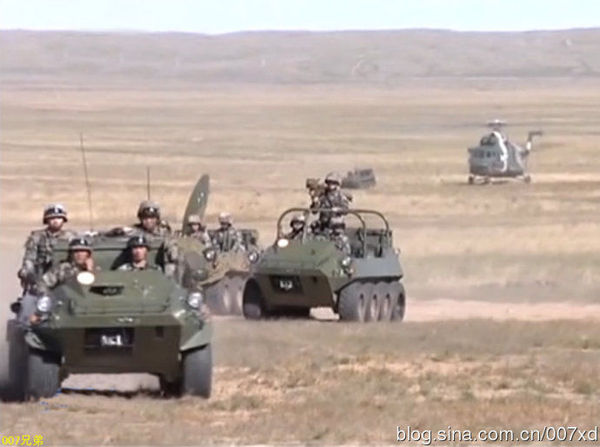
^^ its the same 8 wheel atv which I pointed out a few posts above.
and tanks ofcourse.
and tanks ofcourse.
Re: Latest Chinese boast: should we shiver or die laughing?
Economic options is another stick that China can use. Here is one and recently China agreed to invest billions in Trump's vision of improving infrastructure in the US (something China did not do as enthusiastically in India).
Beijing floats ‘Border Economic Zones’ idea
Beijing floats ‘Border Economic Zones’ idea
China has proposed to establish ‘Border Economic Zones’ on both sides of the border between Nepal and China during a bilateral meeting held in Lhasa last week, Nepali officials participating in the meeting said.
The Chinese side made such a proposal to establish industries to increase economic activities across the border points during a meeting of Nepal-China Trade Facilitation Committee. The committee is a bilateral mechanism between Nepal and Tibet Authority of China to promote trade and settle issues for trade and economic engagement.
“They said that the establishment of border economic zones will help the development of border areas on
both sides,” said Joint Secretary at the Ministry of Commerce Rabi Shankar Sainju, the leader of the Nepali delegation that also included officials of the Ministry of Industry, the Ministry of Agriculture, the Department of Customs, and the Nepal Rastra Bank.
Re: Latest Chinese boast: should we shiver or die laughing?
ok, I expected better from you. Come back in a month.DavidD wrote: I think you're being naive.
So not what Suraj and I are trying to state here. The bolded part is what I alluded to as the chinese lack of interest in breaking a cycle, despite knowing how the cycle ends before a reset. That seemed to be the chinese leadership's thinking too. We had pushed stuff into chinese thinking over eons. Let us see.I can't think of an instance of two great powers forming complementary rather than adversarial roles. It's "us" vs. "them", remember. Some may think it's sad that the human race has been unable to evolve past that, but I'm resigned to the possibility that perhaps this is simply what nature demands--competition and survival of the fittest. Humans are perhaps the greatest species in mass murdering each other, but maybe this is literally what made us humans, a species that dominate the planet?
Re: Latest Chinese boast: should we shiver or die laughing?
Singha, rotary launchers for ALCMs and this ATV is like catnip to you
These things are made for snowy/tundra/slushy conditions, for moving people and supplies over short distances (like a few kms) at slow-to-medium speeds. It is most definitely not an assault vehicle as the PLA wants us to believe. It is a guzzler, more than a snocat or 4x4 ATVs. It can neither go at speed nor has the protection of a basic infantry truck (even for softops, its sideboards provide some minimal shrapnel protection) let alone an MRAP. No patrol will be safe from even entry-level ambushers in this vehicle. As an LMG or mortar base, it will rock a bit hard and would like to know what is the claimed accuracy. It cannot make a "quick" surprise attack, due to its speed. Plus if the troops clamber back for an egress, it provides a beautiful, dense, target-rich kill box for even an LMG or a grenade.
These chinese troopers are doing the same stuff as those Crouching Slowmandos@Segway of Beijing olympics - for reassuring their eastern seaboard about "law enforcement".
Re: Latest Chinese boast: should we shiver or die laughing?
That is the key in many respects. Tibet itself is a huge plain. It is the north western parts that are high plains. The southern parts are more mountainous.NRao wrote:Chinese army launches massive military drill in Tibet
Dec 9, 2016
Chinese army has conducted massive military exercises in Tibet mountainous region, the first such drill after it reconstituted area command which looks after the Line of Actual Control in the Kashmir region.
Over 10,000 soldiers with the People’s Liberation Army (PLA) Xinjiang Military Area Command participated in a defensive drill in a mountainous area rising over 4,000 meters above sea level in Xinjiang Uyghur Autonomous Region, state- run People’s Daily said in brief report with photographs of the drills.
"Defensive drill" is interesting. They know damn well what will happen if the balloon goes up
Re: Latest Chinese boast: should we shiver or die laughing?
Shiv,
There is an excellent elevation map on this page, which may or may not help you.
http://elevation.maplogs.com/poi/tibet_china.18.html
Would be nice if we could superimpose the national maps
There is an excellent elevation map on this page, which may or may not help you.
http://elevation.maplogs.com/poi/tibet_china.18.html
Would be nice if we could superimpose the national maps
Re: Latest Chinese boast: should we shiver or die laughing?
LOL That is one beautiful map and resource - even more meaningful for a person who has been staring at Googe Earth images for hours by the dozen.NRao wrote:Shiv,
There is an excellent elevation map on this page, which may or may not help you.
http://elevation.maplogs.com/poi/tibet_china.18.html
Would be nice if we could superimpose the national maps
I wish more people could understand what they can see even on the image seen from a high altitude. In fact - just by looking at that elevation map I can mark out Chinese roads like the S 201 and 202 and G 219.
The fact that southern Tibet is mountainous and northern Tibet is a plain is clearly visible. Interestingly the mountainous areas of southern Tibet have a few areas of flat grey plain and this is where Lhasa and most of Tibet's population is situated. Also clearly visible on the map are the high mountains to the east of Tibet - near western China that prevent easy access to the Han from the east into Tibet. The easiest access is to skirt the mountains to the by looping north into high plain over the mountains and then heading south to Lhasa. In fact that is exactly what the Chinese have done for their Tibet railway. I will try and superimpose the railway and road map on the elevation map to try and illustrate the engineering a logistical challenges that may be militarily significant
Re: Latest Chinese boast: should we shiver or die laughing?
10,000 men is hardly a `massive exercise'. It may well reflect the logistical limitations the PLA has in moving division level formations
into Tibet.
into Tibet.
Re: Latest Chinese boast: should we shiver or die laughing?
To put that into perspective, the Indo-US Yudh Abhyas 2016 had 225 men from each side.
I assume the 10K had and served a purpose. And a Good one at that.
I assume the 10K had and served a purpose. And a Good one at that.
Re: Latest Chinese boast: should we shiver or die laughing?
NRao wrote:Chinese army launches massive military drill in Tibet
Dec 9, 2016
Flatter than flat.Chinese army has conducted massive military exercises in Tibet mountainous region, the first such drill after it reconstituted area command which looks after the Line of Actual Control in the Kashmir region.
Over 10,000 soldiers with the People’s Liberation Army (PLA) Xinjiang Military Area Command participated in a defensive drill in a mountainous area rising over 4,000 meters above sea level in Xinjiang Uyghur Autonomous Region, state- run People’s Daily said in brief report with photographs of the drills.
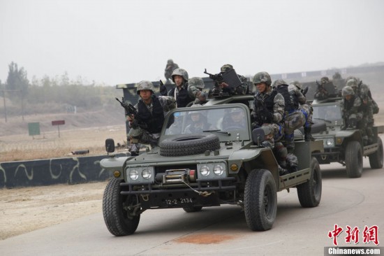
This image and caption are fascinating in the light of what I have seen on Google Earth in a few places.
1. This is a defensive drill
2. There is a trench with at least 3 men and what appear to be mannequins "advancing" on the plain and being shot at.
I am no expert in land combat tactics defensive or offensive and I have been indoctrinated to feel that warfare fought from within static trenches is oh so yesterday
But there are at least two sites in the Aksai Chin and Barahoti area where military installations are actually skirted by furrows that look like trenches. In fact I had seen some earlier in Aksai Chin and I spotted one again last night in the Barahoti/Niti pass region. To me it appears that in these areas - the Chinese are expecting an Indian assault and these defensive positions will be used along with strategically placed medium/heavy weaponry to cut down attackers. Will try and post an image - but in one case the feature was found on GE but the actual image is better on Bing