Wind Energy:
Zoom in and move around and you will see 100s of acres of wind turbines. So India has 2 of the world's 4 largest wind farms, and the worlds 2nd largest solar plant, and another solar park, that generates as much as the world's largest. India has done really really well in renewable energy and really set an example for the world.
Muppandal wind farm:
2nd largest wind farm in the world. Generating 1500 MW
8°15'46.43"N, 77°32'10.12"E
8°16'19.05"N, 77°38'3.29"E
Suzlon Jaisalmer Wind Farm:
This generates 1064 MW and is the world's 4th largest wind farm
26°55'49.99"N, 70°48'37.01"E
There are several others, ranging from 9 MW to several hundred MWs all over the country.
Google Earth updates more cities and airports in India
Re: Google Earth updates more cities and airports in India
Antarctica Stations
Maitri: 70°45'57.37"S, 11°43'54.69"E
Dakshin Gangotri: (Now abandoned and used as a supply base only): Approx location 70°05′37″S 12°00′00″E
Bharti Antarctic Research Station: 69°24'23.38"S, 76°11'44.64"E
Maitri: 70°45'57.37"S, 11°43'54.69"E
Dakshin Gangotri: (Now abandoned and used as a supply base only): Approx location 70°05′37″S 12°00′00″E
Bharti Antarctic Research Station: 69°24'23.38"S, 76°11'44.64"E
Re: Google Earth updates more cities and airports in India
Do people remember the Enron Power Project - Dahbhol Power Station?
There was so much controversy in the late 80s and 90s due to this.
The station was supposed to give super expensive power. After Enron went bust, it was mothballed for 5 years and then GAIL and NTPC took over and now it generates 1967 MW.
740 MW Naptha
1700 MW LNG
17°33'33.11"N, 73° 9'58.12"E
Go southwest slightly and see the large tanks to store fuel and a fuel jetty to directly get fuel from oil tankers from the sea.
Re: Google Earth updates more cities and airports in India
Sardar Sarovar Dam:
which caused so much environment controversy by leftists and environmentalists
21°49'42.69"N, 73°45'8.05"E
which caused so much environment controversy by leftists and environmentalists
21°49'42.69"N, 73°45'8.05"E
Re: Google Earth updates more cities and airports in India
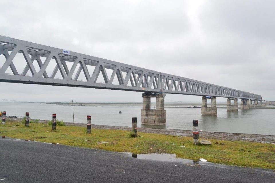
Asia's longest bridge: Dhola-Sadiya Bridge:
27°48'15.81"N, 95°40'33.20"E
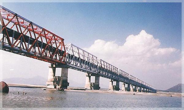
Another almost identical bridge on the lohit river, about 35-40 km upstream is also nearing completion near Alubari
27°51'26.46"N, 96° 1'35.58"E
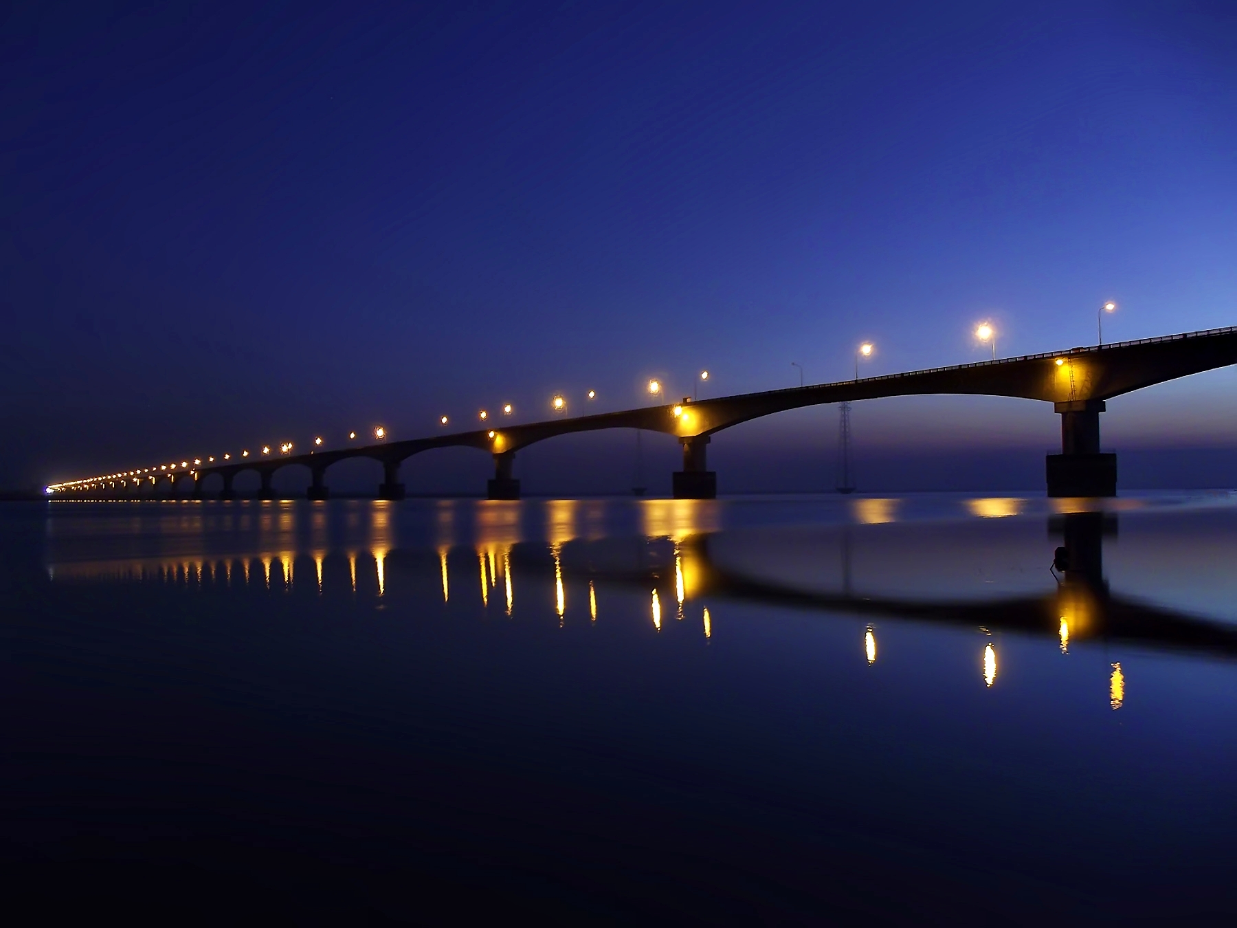
Bogibeel Bridge: Railway + Road bridge on the Brahmaputra, just south-west of Dibrugarh
27°24'18.84"N, 94°45'52.32"E
https://www.youtube.com/watch?v=JkomfU6iVo4
Further south-west, is the Kamalbari-Nimati Ferry service to cross the Brahmaputra. This is near Jorhat
26°51'45.24"N, 94°14'2.23"E
Further west near Tezpur, is the kaliabhomora bridge
26°35'58.99"N, 92°51'28.92"E
Further west, in Guwahati, is the Saraighat Bridge
26°10'24.37"N, 91°40'20.28"E

And Finally, further west is the Naranarayan Setu
26°12'15.88"N, 90°33'35.69"E
27°48'15.81"N, 95°40'33.20"E
Another almost identical bridge on the lohit river, about 35-40 km upstream is also nearing completion near Alubari
27°51'26.46"N, 96° 1'35.58"E
Bogibeel Bridge: Railway + Road bridge on the Brahmaputra, just south-west of Dibrugarh
27°24'18.84"N, 94°45'52.32"E
https://www.youtube.com/watch?v=JkomfU6iVo4
Further south-west, is the Kamalbari-Nimati Ferry service to cross the Brahmaputra. This is near Jorhat
26°51'45.24"N, 94°14'2.23"E
Further west near Tezpur, is the kaliabhomora bridge
26°35'58.99"N, 92°51'28.92"E
Further west, in Guwahati, is the Saraighat Bridge
26°10'24.37"N, 91°40'20.28"E
And Finally, further west is the Naranarayan Setu
26°12'15.88"N, 90°33'35.69"E
Re: Google Earth updates more cities and airports in India
Great find on the alubari bridge. ..east of it is parasuram kund a holy place and a bridge leading road to walong
Re: Google Earth updates more cities and airports in India
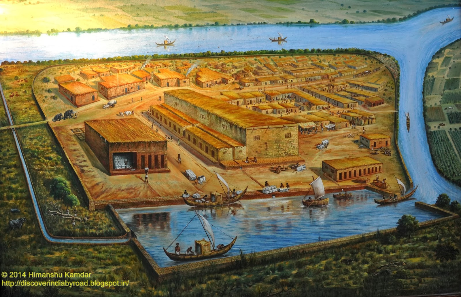
Lothal, Gujarat
5000 year old port, the world's earliest known dock, on the banks of the historical course of the Sabarmati River
22°31'17.58"N, 72°15'6.54"E

5000 year old port, the world's earliest known dock, on the banks of the historical course of the Sabarmati River
22°31'17.58"N, 72°15'6.54"E
Re: Google Earth updates more cities and airports in India
While I know we want to stay away from identifying many military objects in India, this is something cool. On google maps (not earth), at Gwalior, you can see 2 AWACS and more cool- 2 Akash batteries deployed. One each in the 2 pre-prepared air defence sites. One at the eastern end and one at the north western end. Had not seen that before.
Re: Google Earth updates more cities and airports in India
There are more Akash launchers at other places
-
Ankit Desai
- BRFite
- Posts: 635
- Joined: 05 May 2006 21:28
- Location: Gujarat
Re: Google Earth updates more cities and airports in India
Check out updated images from MDL to Gateway of India.
P15 and their progress.
-Ankit
P15 and their progress.
-Ankit
Re: Google Earth updates more cities and airports in India
Also, we can see one scorpeneAnkit Desai wrote:Check out updated images from MDL to Gateway of India.
P15 and their progress.
-Ankit
Re: Google Earth updates more cities and airports in India
Google Earth is frightening. The information available is just too much.