From the twitter link posted above, if you follow
https://www.aspistrategist.org.au/satel ... dia-clash/
there is a lot of detail about Indian and Chinese positions built up recently. Despite assertions that we have matched up Chinese mobilisation on the LAC, it is the mobilisation on Chinese side a few kms behind the LAC which is the threat. This involved construction of several structures, shelters, vehicle parks perhaps material and ammunition dumps etc. From these bases, they equip and send patrols, with sufficient strength to rotate patrol teams not sufficiently acclimatised, and acclimatise a lot more soldiers. The fact that we have lot of acclimatised soldiers is a temporary advantage that is more or less gone by now.
<<< My deductions>>>
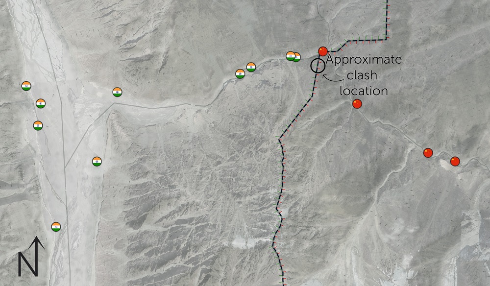
I suspect our night patrol to Point 14
at night must have seen perhaps for the first time, the true extent of Chinese mobilisation, from a
vantage point that gives them a clear line of sight of a few kms into the Chinese side of Galwan river. The lights from the structures, vehicles were a dead give away. They might have climbed higher to get a better look and seen even more of the activity at night. They discovered a tent etc which they immediately destroyed and set fire to, attracting a large group of Chinese troops to rush to the spot. The CO Col Babu leading from the front may have even confronted the Chinese about this having been part of deescalation talks earlier. Realising Indian patrol troop has seen what they have seen, Chinese troops must have decided that can't get back to report this and attacked them. We know the rest.
Indian Army HQ and intelligence agencies would have had this information as well, from our own or other satellites, but its not clear how much of that real time data was given to the CO. Perhaps it was, and that why our troops went and confronted the Chinese troops about it. Perhaps it wasn't but they found out during night patrolling, since the terrain, features and perhaps some camouflage would make it hard to spot during day.
<<< /My deductions>>>
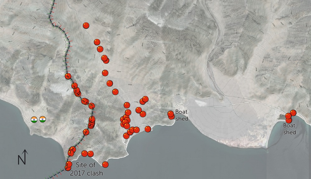
Either way, China's duplicity and devious methods are out in the open for all to see, not just in Galwan but also at Pangong Tso, Hot Springs.
Indian agencies can easily compare successive satellite images to determine the exact sequence and timelines of how the buildups started and progressed, which can tell them the nature of the structures, the capacity and constraints China has to realise such build ups, the equipment and troops they have mobilised in quantity, type, capacity, and so on.
IMO, we don't need to bring (back) more troops to the LAC now, because we have a long list of GPS coordinates to feed into Litening pods and other such standoff systems.... 