Indian Space Program: News & Discussion

The Technology & Economic Forum is a venue to discuss issues pertaining to Technological and Economic developments in India. We request members to kindly stay within the mandate of this forum and keep their exchanges of views, on a civilised level, however vehemently any disagreement may be felt. All feedback regarding forum usage may be sent to the moderators using the Feedback Form or by clicking the Report Post Icon in any objectionable post for proper action. Please note that the views expressed by the Members and Moderators on these discussion boards are that of the individuals only and do not reflect the official policy or view of the Bharat-Rakshak.com Website. Copyright Violation is strictly prohibited and may result in revocation of your posting rights - please read the FAQ for full details. Users must also abide by the Forum Guidelines at all times.
Amber G.
BRF Oldie
Posts: 11242
Joined: 17 Dec 2002 12:31
Location: Ohio, USA

Re: Indian Space Program: News & Discussion

Post by Amber G. »

drnayar wrote: 24 Jul 2025 13:10 ..as someone said., the US optical spy sats [ KeyHole 11 or KH11 ] are similar to Hubble satellites , have mirrors comparable in size to Hubble's (2.4 meters) and utilize similar electro-optical digital imaging, KH11s are bigger as well..looking in the other direction .. and there are quite a few of them.. one can just imagine how much each would cost!
Yes, Thanks for binging that up!

It’s well-known (though not officially confirmed by the U.S. government ;) ) that the KH-11 series, especially the later “CRYSTAL” have mirror sizes around 2.4 meters, just like Hubble... same designs as Hubble’s Ritchey–Chrétien telescope, but pointed down at Earth instead of out into space!

Electro-optical imaging sensors for real-time or near-real-time digital imagery.. (as opposed to old film-return satellites as it was common in 1970''s).

Fun fact: in 2012, two spare Hubble-class telescopes were donated by the NRO (National Reconnaissance Office) to NASA—proof that these spy satellites are indeed Hubble’s secret twins.

Later KH-11s are thought to have longer focal lengths, enabling ultra-high resolution (estimates range from 10–15 cm GSD—ground sample distance).

Yes we can imagine cost is astronomical..
These systems form the backbone of U.S. strategic intelligence gathering ..

In some ways, the U.S. has had “Google Earth-level” resolution (and far better) decades before it became public tech.

(Added: Per Google: KH-11 satellites have been launched regularly since 1976, with the most recent ones in 2021 and 2022, as part of the Evolved Enhanced CRYSTAL class under the NROL (National Reconnaissance Office Launch) missions. They represent the U.S.’s most advanced optical reconnaissance capability.
Amber G.
BRF Oldie
Posts: 11242
Joined: 17 Dec 2002 12:31
Location: Ohio, USA

Re: Indian Space Program: News & Discussion

Post by Amber G. »

Sharing some news : The IIT Kanpur inaugurated a course on “Space Mission Design, Analysis, and Operations” from 28 July to 9 August 2025, as part of the Indian Technical and Economic Cooperation (ITEC) initiative of the Ministry of External Affairs, Government of India.
A_Gupta
BRF Oldie
Posts: 13695
Joined: 23 Oct 2001 11:31
Contact:

Re: Indian Space Program: News & Discussion

Post by A_Gupta »

https://english.gujaratsamachar.com/new ... ch-failure
PSLV-C61 failure: "The National Failure Analysis Committee, reportedly composed of top scientists – more than half of whom are from premier institutions such as the Indian Institute of Science (IISc) and the Indian Institutes of Technology (IITs)—has been tasked with conducting a detailed review. The panel is expected to submit its report by mid-June."

Was anything made public?
Prem Kumar
BRF Oldie
Posts: 4552
Joined: 31 Mar 2009 00:10

Re: Indian Space Program: News & Discussion

Post by Prem Kumar »

NISAR launch successful, per TOI

Kudos to ISRO & NASA!
SSridhar
Forum Moderator
Posts: 25388
Joined: 05 May 2001 11:31
Location: Chennai

Re: Indian Space Program: News & Discussion

Post by SSridhar »

Very accurate orbital injection.
2 Kms dispersion in apogee, 3 Kms in perigee, 0.2 deg in inclination.
Attitude changes done, solar panels deployed & power generation started etc.
bala
BRF Oldie
Posts: 3163
Joined: 02 Sep 1999 11:31
Location: Office Lounge

Re: Indian Space Program: News & Discussion

Post by bala »

For those wanting to see the launch, watch the historic launch of GSLV-F16 carrying the NASA-ISRO Synthetic Aperture Radar (NISAR) satellite, a joint Earth observation mission by ISRO and NASA.

GSLV-F16 Launch with NASA-ISRO NISAR Earth Observation Satellite
https://www.youtube.com/watch?v=OgC1MxtCwq4
drnayar
BRFite
Posts: 1951
Joined: 29 Jan 2023 18:38

Re: Indian Space Program: News & Discussion

Post by drnayar »

bala wrote: 30 Jul 2025 19:07 For those wanting to see the launch, watch the historic launch of GSLV-F16 carrying the NASA-ISRO Synthetic Aperture Radar (NISAR) satellite, a joint Earth observation mission by ISRO and NASA.

GSLV-F16 Launch with NASA-ISRO NISAR Earth Observation Satellite
https://www.youtube.com/watch?v=OgC1MxtCwq4
no hitch at all .. compare to how the spy satellite launches failed ..
Amber G.
BRF Oldie
Posts: 11242
Joined: 17 Dec 2002 12:31
Location: Ohio, USA

Re: Indian Space Program: News & Discussion

Post by Amber G. »

^^^ Congratulations!
( I have made about 5-6 long detail posts about NISAR - starting my first one more than 3 years ago .. when NISAR was scheduled to in 2023 or so - see my next post)

For BRF, some observations/points (as has been made several times here) without exaggeration -

NISAR s a BIG milestone for both NASA and ISRO. It’s the first satellite in the world to use dual-frequency radar—L-band from NASA and S-band from ISRO—on the same platform. That means it can track even tiny changes on Earth’s surface, like shifting glaciers, landslides, or underground water changes, with accuracy down to about a centimeter. It carries a huge 12-meter antenna (NASA’s biggest ever in space), giving it wide coverage and sharp detail in every pass, day or night, rain or shine.

Some standouts

- First-of-its-kind with both L- and S-band SAR onboard

- Massive 12 m radar dish on a 9 m boom—deployed in space

- Churns out ~35 TB of data daily, one of the highest for Earth missions

- Tracks surface shifts as small as 1 cm—ideal for disaster and climate monitoring

- Helps map carbon, biomass, and land use changes

- Works in any weather, 24/7, through clouds, smoke, and forest cover

- A real co-build effort—NASA made the L-band radar; ISRO built the S-band and satellite bus

- In a 90-day commissioning phase now, full science ops expected by late October

- Will release most data openly, with quick turnaround in emergencies

In short, NISAR is like giving Earth an ultra-precise radar eye—hugely useful for scientists, disaster response teams, and climate researchers around the world!
Vayutuvan
BRF Oldie
Posts: 13904
Joined: 20 Jun 2011 04:36

Re: Indian Space Program: News & Discussion

Post by Vayutuvan »

Amber G. wrote: 30 Jul 2025 22:38 ( I have made about 5-6 long detail posts about NISAR - starting my first one more than 3 years ago .. when NISAR was scheduled to in 2023 or so - see my next post)
Wow, well done sir jee. I, for one, am very grateful for your service. I hope that much of sabhashi is enough. If not, don't be shy and tell me. I will give more praise. I will have to ask my IAS friends for more superlative words than I can muster.
Last edited by Vayutuvan on 31 Jul 2025 05:45, edited 1 time in total.
Amber G.
BRF Oldie
Posts: 11242
Joined: 17 Dec 2002 12:31
Location: Ohio, USA

Re: Indian Space Program: News & Discussion

Post by Amber G. »

NISAR – A Joint Journey in Science
- Amber G. (For BRF)

- From someone who’s been following this closely — a scientist-teacher, and a quiet admirer of both nations’ space efforts.

Now that NISAR has successfully launched — a major milestone in US–India cooperation in space science — I thought it might be useful (and a bit satisfying!) to look back at some key moments from its journey.

What follows is a quick recap of updates and reflections I’ve shared in the US–India thread over the last few years. . Please see the detail post(s) under each heading.

Not official press releases — just a collection of informal posts from yours truly, a scientist and teacher who’s been quietly proud of this unique collaboration and what it stands for.

- April 2022 – Diplomatic Spotlight

In the official India–US joint statement, NISAR was mentioned prominently — a sign of how important this scientific mission was to both governments.

It wasn’t just about satellites — it showed how Earth observation and climate science had entered the strategic partnership space.

February 2023 – Nearing the Finish Line
(February 2023 – Nearing the Finish LineII )
1. At-a-glance update:

Shared this brief note:

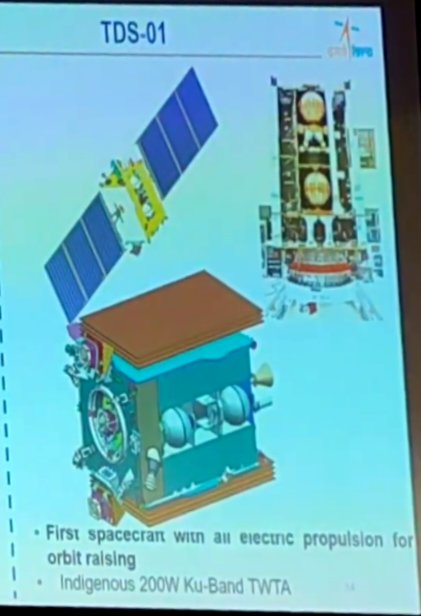
The NASA-ISRO Synthetic Aperture Radar (NISAR) mission was moving toward a 2024 launch.

It would use dual-frequency radar (L-band and S-band) to systematically track changes in forests, water, agriculture, and crustal deformation — all with open-access data.

2. Big move – Payload ships to India:

“Scientific heart of NISAR leaves JPL in style!”

In early Feb 2023, NASA’s radar payload was prepped and officially sent to India after a public rollout.

NASA’s Laurie Leshin and ISRO’s S. Somanath jointly highlighted how this mission could monitor everything from glacier motion to soil moisture.

Posted photos of the equipment inside JPL’s clean room — looked stunning.

August 2023 – Reflections Amid Big Announcements

Around the time news of the Biden-Modi State Visit broke, I re-shared the NISAR post in the context of growing trust and cooperation between the two nations.

Also said this:
I was particularly happy when S. Somanath became ISRO Chairman — he’s respected by both scientists and the public, and also has a solid reputation in NASA and US circles.
Felt like a moment worth acknowledging — one where science, leadership, and diplomacy all aligned.

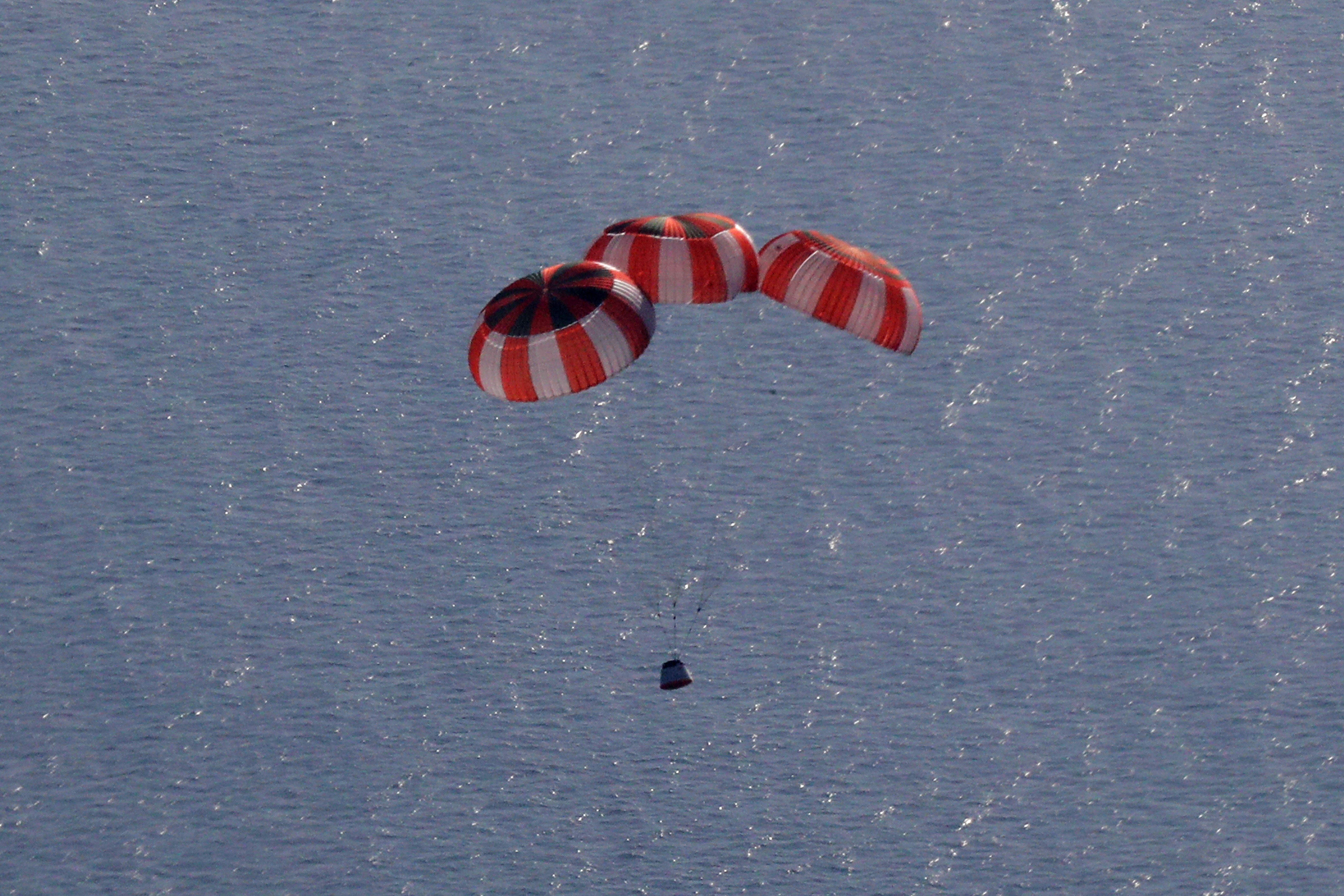
June 2025 – The Launch
Finally, the big news:

NISAR planed to be launched in 2025

I shared a summary of what makes this mission special:

What NISAR does:

Uses synthetic aperture radar to detect minute Earth changes (down to centimeters)

Works day or night, in all weather

Data is freely available — supporting:

Disaster response (e.g., floods, landslides, oil spills)

Climate monitoring (e.g., ice sheets, land deformation)

Agriculture (e.g., soil moisture estimation)

Features include:

Scans land and ice surfaces twice every 12 days

Tracks flooded vegetation, wetlands

Observes glacier motion, coastal erosion

Total cost: approx $1.5 billion

It's a triumph of open science, international trust, and engineering.

I also made it clear I wouldn’t waste time with online trolls — science like this deserves better.

----
Some personal refrection:

Flashy deep-space missions are fun — but missions like NISAR are where real-world impact and international cooperation shine brightest.

From California’s JPL to ISRO’s Satish Dhawan Space Centre, from radar arrays to rice paddies, from glacial flow to groundwater maps — this mission speaks to the planet’s needs.

It’s a proud moment — for science, for diplomacy, and for the many teams across two continents who made it happen.

– Amber G.
SriKumar
BRF Oldie
Posts: 2267
Joined: 27 Feb 2006 07:22
Location: sarvatra

Re: Indian Space Program: News & Discussion

Post by SriKumar »

^^^Does the satellite pick a reference point on the earth to measure movements upto a cm accuracy? The earth is spinning, and the satellite is moving in LEO at a fast speed. Where is the origin of the spatial reference point on earth? Is there an earth-centric coordinate system? And how does the satellite keep a 'lock' on it, with all the relative movements.
Amber G.
BRF Oldie
Posts: 11242
Joined: 17 Dec 2002 12:31
Location: Ohio, USA

Re: Indian Space Program: News & Discussion

Post by Amber G. »

SriKumar wrote: 31 Jul 2025 09:54 ^^^Does the satellite pick a reference point on the earth to measure movements upto a cm accuracy? The earth is spinning, and the satellite is moving in LEO at a fast speed. Where is the origin of the spatial reference point on earth? Is there an earth-centric coordinate system? And how does the satellite keep a 'lock' on it, with all the relative movements.
Great Question!
Short Answer :)

NISAR doesn’t “lock” onto a single point — it uses:
- The ITRF Earth-fixed coordinate system
- Extremely accurate orbit tracking
-InSAR phase comparison over time

...to measure relative surface motion with centimeter or better precision.
---
(Little More explanation - Physics main points)

NISAR uses InSAR (Interferometric Synthetic Aperture Radar), which compares the phase of radar signals reflected from the ground over repeated passes. By analyzing the phase difference between two observations, it can detect surface movement as small as a few centimeters or even millimeters.

To achieve this:

1. Precise Earth-Centered Coordinate System (ITRF):
NISAR uses the International Terrestrial Reference Frame, a global 3D coordinate system anchored by GPS and ground stations worldwide.

It provides a stable, Earth-fixed reference to measure changes against.

2. Highly Accurate Satellite Positioning:
NISAR’s orbit is known to centimeter-level precision using onboard GPS and possibly laser retroreflectors.


3. Relative Motion Detection via InSAR:
The satellite compares radar phase from the same ground location across different orbits (~every 12 days).

Any ground shift changes the path length, which alters the radar phase — allowing detection of motion.

Thus

NISAR detects surface changes by comparing radar phase over time, using a stable Earth-fixed coordinate system (ITRF) and precise satellite positioning. No single fixed ground point is needed — it’s all relative motion.

(Yes, the Earth rotates — but that’s predictable and modeled.
-Yes, tectonic plates shift — but again, that's what NISAR is meant to measure.
-The key is to calibrate out known motions, so that what’s left is the change you care about: landslides, earthquakes, glacier movement, etc.)
nits
BRFite
Posts: 1211
Joined: 01 May 2006 22:56
Location: Some where near Equator...

Re: Indian Space Program: News & Discussion

Post by nits »

Can Nisar tech can act as base for our future spy satelites
SriKumar
BRF Oldie
Posts: 2267
Joined: 27 Feb 2006 07:22
Location: sarvatra

Re: Indian Space Program: News & Discussion

Post by SriKumar »

Amber G. wrote: 31 Jul 2025 11:23 NISAR detects surface changes by comparing radar phase over time, using a stable Earth-fixed coordinate system (ITRF) and precise satellite positioning. No single fixed ground point is needed — it’s all relative motion.

(Yes, the Earth rotates — but that’s predictable and modeled.
-Yes, tectonic plates shift — but again, that's what NISAR is meant to measure.
-The key is to calibrate out known motions, so that what’s left is the change you care about: landslides, earthquakes, glacier movement, etc.)
Interesting, thanks. Since the phase difference is being measured, does the satellite compute the velocity of the target (e.g. a glacier) i.e. via Doppler effect? How do they account for scatter of signal and accompanying loss of strength, which is to be expected from a lot of earth surfaces e.g. forests, and water even.
The ITRF system sounds very interesting. It seems like it is a computational model to account for mass flows within earth and on surface as well (including plate movements). It seems like everything is moving, and corrections based on new observations and new computations are applied periodically, to establish a newer reference point and frame. Any comment on how many GPS stations are needed on earth surface to achieve a reasonable level of positional accuracy?

I recall your mentioning that relativity was used to adjust the timing calculations since the time duration of received/reflected signals is so low. To what extent are regular Newtonian equations of motion are used in velocity and distance calculations. Thanks
Amber G.
BRF Oldie
Posts: 11242
Joined: 17 Dec 2002 12:31
Location: Ohio, USA

Re: Indian Space Program: News & Discussion

Post by Amber G. »

SriKumar wrote: 31 Jul 2025 21:14
Amber G. wrote: 31 Jul 2025 11:23 NISAR detects surface changes by comparing radar phase over time, using a stable Earth-fixed coordinate system (ITRF) and precise satellite positioning. No single fixed ground point is needed — it’s all relative motion.

(Yes, the Earth rotates — but that’s predictable and modeled.
-Yes, tectonic plates shift — but again, that's what NISAR is meant to measure.
-The key is to calibrate out known motions, so that what’s left is the change you care about: landslides, earthquakes, glacier movement, etc.)
Interesting, thanks. Since the phase difference is being measured, does the satellite compute the velocity of the target (e.g. a glacier) i.e. via Doppler effect? How do they account for scatter of signal and accompanying loss of strength, which is to be expected from a lot of earth surfaces e.g. forests, and water even.
The ITRF system sounds very interesting. It seems like it is a computational model to account for mass flows within earth and on surface as well (including plate movements). It seems like everything is moving, and corrections based on new observations and new computations are applied periodically, to establish a newer reference point and frame. Any comment on how many GPS stations are needed on earth surface to achieve a reasonable level of positional accuracy?

I recall your mentioning that relativity was used to adjust the timing calculations since the time duration of received/reflected signals is so low. To what extent are regular Newtonian equations of motion are used in velocity and distance calculations. Thanks
Thanks—great questions.

- No, we’re not measuring velocity directly. Doppler isn’t used that way in InSAR.
Phase differences are central to InSAR (Interferometric Synthetic Aperture Radar). The technique doesn’t directly use Doppler shifts in the classical sense to compute target velocity—instead, it measures how much the radar phase has changed between two passes.

For things like glacier movement or ground deformation, the phase shift over time reveals displacement, which when divided by time gives you velocity (though typically over days to weeks).

Doppler information can be used in SAR processing (e.g., to help localize the image in azimuth), but it's not the main tool for measuring surface motion.

What we do measure is the phase difference between radar returns - "base" - from two satellite passes (say, 12 days apart). Since the satellite's position is known to within centimeters, any phase shift can be tied to actual surface displacement (millimeter-level).

Yes, surfaces like forests or water scatter signals—L-band helps mitigate this (penetrates foliage better), and signal processing filters extract usable data even from noisy returns.

L-band (~25 cm): penetrates vegetation better and gives more stable returns over forests, soil, and ice.

S-band (~10 cm): higher resolution but more susceptible to scattering—used more for surfaces like dry land or infrastructure.

NISAR's processing algorithms are designed to filter out noise, and it uses multi-look averaging, coherence maps, and clever phase unwrapping techniques to still extract usable motion data even from "messy" surfaces.

Regarding ITRF—you’re spot on. Everything on Earth moves: plates, glaciers, even the crust. ITRF is a dynamic reference frame, constantly updated using data from GPS, VLBI, SLR, DORIS networks.

Corrections are updated periodically (e.g., ITRF2020 is the latest release), reflecting new geophysical observations and refined models.

How Many GPS Stations Are Needed?
Globally, hundreds of continuously operating GPS stations contribute to high-precision positioning. But for most scientific and InSAR-grade applications:

You need at least 3–4 well-placed stations locally to get solid differential GPS (DGPS) or precise point positioning (PPP) accuracy.

For global accuracy (like for ITRF), you want dozens to hundreds, well-distributed across all continents and islands.

NISAR’s orbit accuracy is supported by a combination of onboard dual-frequency GPS and ground-based tracking, with centimeter-level precision.


As for relativity: it’s essential for satellite clocks (GPS etc.) due to GR + SR time offsets, but not needed for orbital mechanics—Newtonian physics handles that well, with only minor corrections.

(GPS satellites tick faster due to being in a weaker gravity field (GR), and also slower due to moving at orbital speeds (SR).

Net effect: clocks on GPS satellites are adjusted by ~38 microseconds/day to stay in sync with Earth-based clocks.) (BRF has quite a few posts from me wrt to this)

If you're curious, look up resources on InSAR, phase unwrapping, and ITRF/ITRS—lots of great material out there.

Let me know if you'd like links or diagrams.

—Amber G.

PS: Hope it's useful — feel free to let me know. (A quick acknowledgment often encourages people to take the time to respond to technical questions in a more thoughtful and useful way.)
Jayram
BRFite
Posts: 378
Joined: 14 Jan 2003 12:31

Re: Indian Space Program: News & Discussion

Post by Jayram »

Thanks Amber G for highlighting this project on BR.
Amber G. wrote: 30 Jul 2025 22:38 ^^^ Congratulations!


Some standouts

- First-of-its-kind with both L- and S-band SAR onboard

- Massive 12 m radar dish on a 9 m boom—deployed in space

- Churns out ~35 TB of data daily, one of the highest for Earth missions
A very small nitpick that number is projected to be 85 TB of data daily and on Public cloud accessible to all.

Some huge numbers requiring big computing to get to usefull conclusions.
From here https://www.earthdata.nasa.gov/news/now ... -from-data
SriKumar
BRF Oldie
Posts: 2267
Joined: 27 Feb 2006 07:22
Location: sarvatra

Re: Indian Space Program: News & Discussion

Post by SriKumar »

Amber G. wrote: 04 Aug 2025 10:52 Let me know if you'd like links or diagrams.
—Amber G.
PS: Hope it's useful — feel free to let me know. (A quick acknowledgment often encourages people to take the time to respond to technical questions in a more thoughtful and useful way.)
Yes, this is all very useful and interesting- especially the numbers. The amount of foundational work that went behind development of infrastructure is astounding, and really is not obvious unless one starts to dig. If you are inclined to post links and diagrams, I'll certainly peruse them.

So I looked up interferometry and I think it is the same phenomenon as what one sees for Newton's rings (we did this expnt in high school) and possibly the same phenomenon is at work that shows rainbow colors to oil on water i.e. constructive and destructive interference. It is quite amazing that this is applicable over such vast distances (400+ kms)- robust enough to be practical.

A couple of follow-up questions: For the ITRF model to model earth's center of mass location, does it also have to model magma flows? If the accuracy of the center of mass is to be in the order of cms, I assume it needs to model molten lava flows in the earth's mantle. So the phsyics would be quite complex to model liquid flow and also interaction with rigid bodies (tectonic plates) on top. I dont know how they would validate such models.

In all of this, I dont see any frame of reference (i.e. the origin of the frame of reference) that is actually static. Not on earth. I recall your saying once that satellite navigation uses quasars as a frame of refence, which are distant enough and relatively still with respect to our solar system (or galaxy). So, would these be THE frame of reference relative to which all satellites AND earth stations are calibrated to? I am not 100% sure and it sounds a bit odd to be calibrating the location of a ground station on earth relative to distant star. But if the earth and GPS frames have to be aligned, I believe the only 'static' point of reference for both are quasars. Any comments? (I did google a bit, but will be glad to read any explanations you provide). Thank you.
Prem Kumar
BRF Oldie
Posts: 4552
Joined: 31 Mar 2009 00:10

Re: Indian Space Program: News & Discussion

Post by Prem Kumar »

Thanks Amber G for your insightful posts!

On a slightly different topic, which we discussed in the previous page, here is a scathing write-up of our IRNSS/NavIC system which is 1 clock-failure away from becoming completely defunct!

There is no sense of urgency or strategic planning & execution

And most of this analysis has come from OSINT (passionate Tweeples). Both ISRO & the MoD need to be raked over the coals for this!

https://swarajyamag.com/science/navic-h ... y-a-thread
drnayar
BRFite
Posts: 1951
Joined: 29 Jan 2023 18:38

Re: Indian Space Program: News & Discussion

Post by drnayar »

One can add all the failed spy satellite launches to the list !!
Amber G.
BRF Oldie
Posts: 11242
Joined: 17 Dec 2002 12:31
Location: Ohio, USA

Re: Indian Space Program: News & Discussion

Post by Amber G. »

Thanks-
Jayram -for nice article on NISAR's - what to expect from its Earth Monitoring Data and Prem Kumar for the article in Swarjya's article.. worth reading both.

(IMO -Swarajya's analysis is quite accurate on the technical and strategic risks facing NavIC today. and it highlights the operational limitations posed by failing satellites.

Though a few points not mention there may be some good news - we will see..
- recent policy measures to use NavIC for domestic time synchronization ('one nation, one time' - and reducing reliance on GPS-based timekeeping infrastructure )
- Qualcomm etc integrating NavIC support in modern chipsets, and ISRO’s NavIC Service Advisory portal or message authentication rollouts are important.

Thanks again.
Amber G.
BRF Oldie
Posts: 11242
Joined: 17 Dec 2002 12:31
Location: Ohio, USA

Re: Indian Space Program: News & Discussion

Post by Amber G. »

SriKumar wrote: 05 Aug 2025 06:55 ..
So I looked up interferometry and I think it is the same phenomenon as what one sees for Newton's rings (we did this expnt in high school) and possibly the same phenomenon is at work that shows rainbow colors to oil on water i.e. constructive and destructive interference. It is quite amazing that this is applicable over such vast distances (400+ kms)- robust enough to be practical.
Glad you found it useful! Yes, you're spot on: the same basic principle of constructive and destructive interference—like in Newton’s rings or oil films—is exactly what’s at play in radar interferometry. What’s amazing is how precisely it works even from hundreds of kilometers above, thanks to stable radar wavelengths, orbital accuracy, and signal coherence.

Interferometers show up everywhere—from Michelson’s historic optical interferometer (used to measure stellar diameters like Betelgeuse, and in the famous Michelson–Morley experiment) to modern radio-astronomy arrays (VLBI) and kilometer-scale laser setups like LIGO, which detect gravitational-wave strains of order 10^-(21) m — corresponding to displacements on the order of
10^(-18) meters , far smaller than an atom!!! . All these systems exploit the same interference of waves (phase differences) to measure extremely tiny path changes, so the same basic physics that makes Newton’s rings and oil-film colors work is scaled up and made exquisitely precise in instruments from radar/InSAR to gravitational-wave detectors.

About LIGO — I’ve shared several posts (dozens - just do a search) and links in the Physics thread. In recent years, it’s been big news: Nobel Prizes (several), global headlines, and major international collaborations. India has taken notice — with Prime Minister Modi publicly supporting the LIGO-India project and committing significant funding. It’s a great example of how foundational physics research can capture worldwide attention and inspire large-scale investment.
--
Amber G.
BRF Oldie
Posts: 11242
Joined: 17 Dec 2002 12:31
Location: Ohio, USA

Re: Indian Space Program: News & Discussion

Post by Amber G. »

SriKumar wrote: 05 Aug 2025 06:55 A couple of follow-up questions: For the ITRF model to model earth's center of mass location, does it also have to model magma flows? If the accuracy of the center of mass is to be in the order of cms, I assume it needs to model molten lava flows in the earth's mantle. So the phsyics would be quite complex to model liquid flow and also interaction with rigid bodies (tectonic plates) on top. I dont know how they would validate such models.

In all of this, I dont see any frame of reference (i.e. the origin of the frame of reference) that is actually static. Not on earth. I recall your saying once that satellite navigation uses quasars as a frame of refence, which are distant enough and relatively still with respect to our solar system (or galaxy). So, would these be THE frame of reference relative to which all satellites AND earth stations are calibrated to? I am not 100% sure and it sounds a bit odd to be calibrating the location of a ground station on earth relative to distant star. But if the earth and GPS frames have to be aligned, I believe the only 'static' point of reference for both are quasars. Any comments? (I did google a bit, but will be glad to read any explanations you provide). Thank you.
There is no truly static or absolute frame of reference (per Einstein and all modern physics - it doesn't exist). We don’t NEED one. What we do need is a well-defined, stable enough frame of reference, with sufficient accuracy, so we can compare positions over time meaningfully.

In satellite geodesy and navigation (like GPS or NISAR), we use the International Terrestrial Reference Frame (ITRF), which itself is tied to VLBI (Very Long Baseline Interferometry) observations of distant quasars. These quasars, billions of light years away, are so far and stable (on human timescales) that their apparent motion is negligible—making them excellent as "fixed" points to anchor a global reference system.

So yes, in practice, ground stations and satellites are tied back—via intermediate steps—to a celestial frame based on quasars. It may sound odd at first, but that’s how we can get consistent centimeter-level global positions and track tectonic drift, satellite orbits, or glacier movement with confidence.

To be clear: we’re not calibrating every GPS device to quasars directly—but the whole global reference system, including Earth stations and satellite ephemerides, is ultimately anchored that way.

Hope this helps clarify a bit — and as always, happy to elaborate (But any good reference - obviously also covers the)

PS: Hope it’s useful — feel free to let me know. (Acknowledgments often help folks take time for thoughtful responses! ;) )
Post Reply